Maps of Appennini

[Kaart], uit: Italie (section Centrale)
1 : 600000 Paris : Taride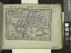
The Signorie or Dominions of Florence.
from Abraham Ortelius his epitome of the theater of the worlde / nowe latlye ... renewed and augmented ... by Micheal Coignet, mathematitian of Antwarpe.
Carte De La Mer Mediterranee. IV.
Roux, Joseph
Italy II.
1 : 1770000 Society for the Diffusion of Useful Knowledge (Great Britain)
Ancient Italy II.
1 : 1770000 Society for the Diffusion of Useful Knowledge (Great Britain)
Italy, North Part.
1 : 2500000 Tanner, Henry S.
Northern Italy.
1 : 1270000 Mitchell, Samuel Augustus
Northern Italy.
1 : 1270000 Mitchell, Samuel Augustus
Italy middle, upper.
1 : 1100000 Robert Laurie & James Whittle
De kusten van Italien, de Noord kust van Sicilia als ook de Oost kusten van Corcica en Sardinia
Italy Henri Michelot & Laurent Brémond Gerard van Keulen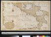
De kusten van Itaalien van 't eijlandElba tot C. della Colomme als ook een gedeelte van de eijlanden van Corsica Sardinia en Sicilia int groodt
Italy Gerard van Keulen
Postkarte von Mittel Italien
Itálie střední Ponheimer, Kilian im von Reillyschen Landkarten und Kunstwerke Verschleiss Komptoir
Bassins du Tibre, de l'Arno, et du Garigliano : (Italie centrale)
1 : 2120000 Vuillemin, Alexandre Aimé 1812-1880 Paris : Delalain
Paskaart der Zeekusten van Italien Tußchen Piombino, en C. dell Arm Met de Noord-kust van't Eylan Sicilia Met Privilegie, voor 15 Iaaren.
1 : 1100000 Mollova mapová sbírka Keulen, Johannes van Keulen, Johann
Stato Della Chiesa, Con La Toscana. [Karte], in: Novus Atlas, das ist, Weltbeschreibung, Bd. 3, S. 157.
1 Karte aus Atlas Blaeu, Joan Blaeu, Willem Janszoon
Italia střední
Itálie Lotter, Tobias Conrad Wagner, Jan Eduard sklad Karla Andréa
Stato Della Chiesa, Con La Toscana. [Karte], in: Theatrum orbis terrarum, sive, Atlas novus, Bd. 3, S. 137.
1 Karte aus Atlas Blaeu, Joan Blaeu, Willem Janszoon
Etats de l'Eglise
1 : 850000 Mollova mapová sbírka Nolin, Jean-Baptiste Nolin, Jean Baptiste II.
Status Ecclesiastici Magnique Ducatus Florentini
1 : 870000 Mollova mapová sbírka Homann, Johann Baptist Homann, Johann Baptista

Carta d'Italia alla scala di 1 a 1 000 000
1 : 1000000 Westblatt Istituto Geografico Militare (Firenze) Istituto Geografico Militare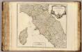
Etat de l'Eglise, Toscane et Corse.
1 : 930000 Robert de Vaugondy, Gilles, 1688-1766
STATO DELLA | CHIESA | CON LA TOSCANA
Guiljelmus Blaeu | excudit
Stato della Chiesa con la Toscana
1 : 1035000 Annotatie: Met opdracht van Henricus Hondius; Origineel is Blad 162 in atlas factice; Annotatie geografische gegevens: Schaalstokken op de kaart: 60 Milliaria Italica communia (=10 cm), en: 12 Milliaria Germanica communia (=8,6 cm) Amstelodami : Sumptibus Ioannis Ianssonii
Stato Della Chiesa. Dominium Ecclesiasticum In Italia. [Karte], in: Gerardi Mercatoris et I. Hondii Newer Atlas, oder, Grosses Weltbuch, Bd. 2, S. 299.
1 Karte aus Atlas Mercator, Gerhard und Hondius, Jodocus Jansson, Jan
Italien Eigendlich also genandt
1 : 2900000 Mollova mapová sbírka Bodenehr, Gabriel Bodenehr, Gabriel
Estats de l'eglise et de Toscane
1 : 790000 Toskánsko (Itálie) Jaillot, Bernard-Jean-Hyacinthe B. Jaillot
Continentis Italiae Pars Media, Seu Prima Meridionalis; Ecclesiae Status Tredecim, et Magni Ducatus Toscani Dominium ac Territoria exhibens
1 : 870000 Mollova mapová sbírka Schenk, Pieter Schenk, Peter II
Stato Della Chiesa Con La Toscana [Karte], in: Novus atlas absolutissimus, Bd. 5, S. 142.
1 Karte aus Atlas Janssonius Offizin
![[Kaart], uit: Italie (section Centrale)](https://images-0.georeferencer.com/images/iiif/743417266122/full/,300/0/native.jpg)

