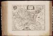
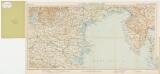
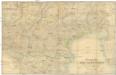
Maps of Veneto
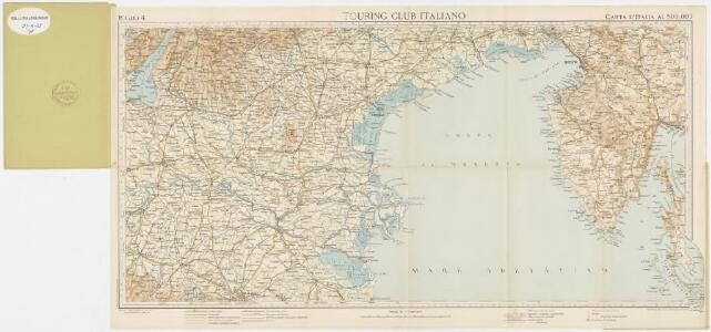
Foglio 4, uit: Carta d'Italia alla scala di 1:500.000 / Touring Club Italiano
1 : 500000 Annotatie: Voor aanwezige bladen zie overzichtsblad Touring Club Italiano Milano : Touring Club Italiano
F. Handtke's Special-Karte von Mittel-Europa No. 37

F. Handtke ́s Special-Karte von Mittel Europa No 36-37
Corografia dell' alta Italia
1 : 288000 Itálie severní
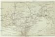
Le Cours Du Po
1 : 450000 Mollova mapová sbírka Nolin, Jean-Baptiste Leonard, Jean
Venizia
1 : 500000 Woerl, Joseph Edmund
Karte von den Ländern welche durch den zwischen Oesterreich und Frankreich zu Campo Fromido bey Udine den 17 October 1797 geschlossenen Frieden an das Erzhaus abgetreten worden
Dalmácie (Chorvatsko) Reilly, Franz Johann Josef von F.J.J. von Reilly

Karte von den Ländern welche durch den zwischen Oesterreich und Frankreich zu Campo Formido bey Udine den 17 October 1797 geschlossenen Frieden an das Erzhaus abgetreten wurden
1 : 770000 Benátsko (Itálie) Reilly, Franz Johann Josef von F. J. J. von Reilly
Troisieme Carte du Téâtre de la Guerre en Italie
1 : 420000 Mollova mapová sbírka Mortier, Pieter Mortier, Pierre
Übersichtskarte von Mittel - Europa

Charte von dem oesterreichischen Herzogthume Venedig
Benátsko (Itálie) Ossenbrug, J. von Kunst und Industrie Comptoirs
Sheet XII: Karte Des Oesterreichischen Kaiserstaates.
1 : 576000 Scheda, Josef
État de la Maison d'Autriche en Italie
1 : 530000 Benátsko (Itálie)
Strassen Karte des Lombardisch-Venezianischen Koenigreiches
1 : 435300 Benátsko (Itálie) Stein, Carl
Strassen Karte des Lombardisch-Venezianischen Koenigreiches
1 : 435300 Benátsko (Itálie) Stein, Carl
Carte de l'ancienne Venetie
1 : 550000 Benátky-oblast (Itálie) Filiasi, Jacques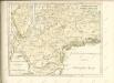

Veronae Vicentiae Et Patavii Ditiones [Karte], in: Gerardi Mercatoris Atlas, sive, Cosmographicae meditationes de fabrica mundi et fabricati figura, S. 447.
1 Karte aus Atlas Mercator, Gerhard Montanus, Petrus

Carta Generale del Regno Lombardo-Veneto e paesi limitrofi... IV.
Les provinces du Veronese, du Vicentin du Padouan, de Polesine de Rovigo et du Dogado ou duché a la République de Venise, les duchés de Mantoue, de la Mirandole & c
1 : 270000 Benátky-oblast (Itálie) Jaillot, Alexis-Hubert H. Iaillot
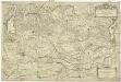
Das dem Erzhause Oesterreich zugefallene venetianische Istrien, die Stadt Venetig, Patria del Friuli, il Cadorino, il Bellunese, il Feltrino, la Marca Trevigiana, il Paduano und il Polesino di Rovigo
1 : 719000 Belluno (Itálie)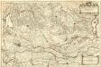
Les Provinces du Veronese, du Vicentin du Padouan, de Polesine de Rovigo et du Dogado ou Duché, a la République de Venise. Les Duchés de Mantoue, de la Mirandole &c.
1 : 260000 Mollova mapová sbírka Jaillot, Alexis-Hubert Jaillot, Alexis Hubert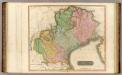
Venetian States.
1 : 410000 Thomson, John
Carte Nouvelle du Padouana, et le Polsin de Ruvigo, de la Republique de Venise [...] [Karte], in: Atlas nouveau, contenant toutes les parties du monde [...], Bd. 2, S. 160.
1 Karte aus Atlas Sanson, Nicolas Jaillot, Alexis Hubert und Mortier, Pieter
[Venetien]
1 : 3000000 Venetien Einigungskriege
Territorio Padovano. [Karte], in: Gerardi Mercatoris et I. Hondii Newer Atlas, oder, Grosses Weltbuch, Bd. 2, S. 255.
1 Karte aus Atlas Mercator, Gerhard und Hondius, Jodocus Jansson, Jan