Maps of Güstrow-Land

42. Schwerin i. M., uit: Topographische Uebersichtskarte des Deutschen Reiches / herausgegeben v. d. Kartogr. Abt. d. Königl. Preuß. Landesaufnahme
1 : 200000 titelvariant: Topogr. Übersichtskarte des Deutschen Reiches; Annotatie: Titel boven bladen ook: Topogr. Übersichtskarte des Deutschen Reiches; Annotatie geografische gegevens: Op elk blad twee maatstokken: 10 Kilometer = 5,5 cm; 1 geogr. Meile = 3,6 cm; Legenda onder op elk blad Königlich Preußische Landesaufnahme. Kartographische Abtheilung [S.l : Königlich Preußische Landesaufnahme, Kartographische Abtheilung]
Composite: 116. Wismar. (Germany)
1 : 100000 Reichsamt fur Landesaufnahme
150. Goldberg. (Germany)
1 : 100000 Reichsamt fur Landesaufnahme
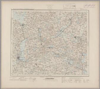
Composite: 117. Gustrow. (Germany)
1 : 100000 Reichsamt fur Landesaufnahme
117. Gustrow. (Germany)
1 : 100000 Reichsamt fur Landesaufnahme
Composite: 150. Goldberg. (Germany)
1 : 100000 Reichsamt fur Landesaufnahme
116. Wismar. (Germany)
1 : 100000 Reichsamt fur Landesaufnahme
Composite: 149. Schwerin. (Germany)
1 : 100000 Reichsamt fur Landesaufnahme
149. Schwerin. (Germany)
1 : 100000 Reichsamt fur Landesaufnahme
Accurater Abriss der Stadt und Festung Wismar.
1 : 50000 Mollova mapová sbírka Busch, Georg Paul Riediger, Johann Adam
Particulier-Carte der Gegend Von Wismar nebst Der Insul Pöel und angedeuteter Bloquade zu Wasser und Lande 1715
1 : 45000 Mollova mapová sbírka Varenius, Heinrich Homann, Johann Baptista
De Haven En Stad Wismar Desselfs Districkt Belegering En Werken Daer Voor
Mollova mapová sbírka Keulen, Gerard van Anse, Luggert van Keulen, Gerard van
Meßtischblatt 2439 : Karow, 1951
1 : 250000 Karow. - Hrsg. 1882, letzte Nachtr. 1888. - 1:25000. - [S.l.]: Landesregierung Sachsen, Abt. Vermessungswesen , 1951. - 1 Kt.
Meßtischblatt 1042 : Goldberg in Mecklenburg, 1936
1 : 250000 Goldberg in Mecklenburg. - Aufn. 1882, kl. Nachtr. 1919. - 1:25000. - [Berlin]: Reichsamt für Landesaufnahme, 1936. - 1 Kt.
Meßtischblatt 2437 : Herzberg, 1935
1 : 250000 Herzberg i. Mecklenburg. - Hrsg. 1881 ?. - 1:25000. - [Berlin]: Reichsamt für Landesaufnahme, 1935. - 1 Kt.
Meßtischblatt 2436 : Frauenmark, 1951
1 : 250000 Frauenmark. - Hrsg. 1881. - 1:25000. - [Berlin]: Landesregierung Sachsen, Abt. Vermessungswesen, 1951. - 1 Kt.
Meßtischblatt 2435 : Crivitz, 1935
1 : 250000 Crivitz. - Hrsg. 1881, ber. 1904, einz. Nachtr. 1919. - 1:25000. - [Berlin]: Reichsamt für Landesaufnahme, 1935. - 1 Kt.
Meßtischblatt 2434 : Sülstorf, 1881
1 : 250000 Sülstorf. - Aufn. 1879. - 1:25000. - [Berlin]: Reichsamt für Landesaufnahme, 1881. - 1 Kt.
Meßtischblatt 2339 : Krakow, 1936
1 : 250000 Krakow. - Hrsg. 1882. - 1:25000. - [Berlin]: Reichsamt für Landesaufnahme, 1936. - 1 Kt.
Meßtischblatt 2338 : Dobbertin, 1950
1 : 250000 Dobbertin. - Hrsg. 1882, Ausg. 1914. - 1:25000. - [S.l.]: Landesregierung Sachsen-Anhalt, Anstalt für Kartographie und Kartendruck, 1950. - 1 Kt.
Meßtischblatt 2337 : Borkow, 1952
1 : 250000 Borkow. - Hrsg. 1882, Ausg. 1928. - 1:25000. - [S.l.]: Vermessungsdienst des Landes Sachsen-Anhalt, 1952. - 1 Kt.
Meßtischblatt 2335 : Langen- Brütz, 1935
1 : 250000 Langen- Brütz. - Hrsg. 1881. - 1:25000. - [Berlin]: Reichsamt für Landesaufnahme, 1935. - 1 Kt.
Meßtischblatt 2334 : Schwerin in Mecklenburg, 1939
1 : 250000 Schwerin in Mecklenburg. - Hrsg. 1881, bericht. 1939. - 1:25000. - [Berlin]: Reichsamt für Landesaufnahme, 1939. - 1 Kt.
Meßtischblatt 942 : Schwerin in Mecklenburg, 1912
1 : 250000 Schwerin in Mecklenburg. - Aufn. 1879, hrsg. 1881, bericht. 1904, einz. Nachtr. 1912. - 1:25000. - [Berlin]: Reichsamt für Landesaufnahme, 1912. - 1 Kt.
Meßtischblatt 2239 : Güstrow, 1950
1 : 250000 Güstrow. - Hrsg. 1882, Ausg. 1931. - 1:25000. - [S.l.]: Landesregierung Sachsen-Anhalt, Anstalt für Kartographie und Kartendruck, 1950. - 1 Kt.
Meßtischblatt 2238 : Zehna, 1950
1 : 250000 Zehna. - Hrsg. 1882, Ausg. 1931. - 1:25000. - [S.l.]: Landesregierung Sachsen-Anhalt, Anstalt für Kartographie und Kartendruck, 1950. - 1 Kt.
Meßtischblatt 848, neue Nr. 2237 : Gr. Raden, 1931
1 : 250000 Gr. Raden. - Aufgen. 1880, hrsg. 1882, bericht. 1928, einz. Nachtr. 1931. - 1:25000. - [Berlin]: Reichsamt für Landesaufnahme, 1931. - 1 Kt.
Meßtischblatt 2236 : Brüel, 1919
1 : 250000 Brüel. - Hrsg. 1881. - 1:25000. - [Berlin]: Reichsamt für Landesaufnahme, 1919. - 1 Kt.
Meßtischblatt 2235 : Hohen- Viecheln, 1881
1 : 250000 Hohen- Viecheln. - Hrsg. 1879. - 1:25000. - [Berlin]: Reichsamt für Landesaufnahme, 1881. - 1 Kt.