Maps of Primorsko-Goranska

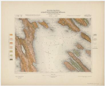
Zone 26, Col. XI, Cherso und Arbe, uit: Geologische Karte der im Reichsrathe vertretenen Königreiche und Länder der Österreich-Ungarischen Monarchie : auf Grundlage der Specialkarte i.M. 1:75.000 des k.u.k. Militär-geographischen Institutes / neu bearb. und als Kartenwerk von 341 Blattnummern in zwanglosen Lfg. hrsg. durch die k.k. Geologische Reichsanstalt in Wien
1 : 75000 titelvariant: Geologische Spezialkarte der im Reichsrate vertretenen Königreiche und Länder der Österreichisch-Ungarischen Monarchie; Geologische Specialkarte der im Reichsrathe vertretenen Königreiche und Länder der Österreichisch-Ungarischen Monarchie; Annotatie: Titel bovenaan kaartblad: Geologische Spezialkarte der im Reichsrate vertretenen Königreiche und Länder der Österreichisch-Ungarischen Monarchie en Geologische Specialkarte der im Reichsrathe vertretenen Königreiche und Länder der Österreichisch-Ungarischen Monarchie; Annotatie geografische gegevens: Coördinaten gebaseerd op nulmeridiaan van Ferro (Hierro) Kaiserlich-Königliche Geologische Reichsanstalt, Wenen Wien : K.K. Geologische Reichsanstalt
Arbe
1 : 200000 Kroatien Rab
Plan of Ports in the Adriatic - Kerso Port

Cherso und Arbe.
from Spezialkarte der osterreichisch-ungarischen Monarchie.
Physikalische Karte des Quarnero nach Dr. J. R. Lorenz
1 : 580000 Kroatien, Kvarner Freytag, Gustav
Pulj
1 : 200000 Pula (Chorvatsko) Kartografska radionica
Adriatisches Meer, Küsten-Karte
1 : 180000 Istrijský poloostrov (Slovinsko a Chorvatsko) Oesterreicher, Tobias von Hydrographisches Amt der k. u. k. Kriegs-Marine
Carta del litorale Austriaco
1 : 440000 Istrijský poloostrov (Slovinsko a Chorvatsko) Schwarzer, Ernesto de
Skelet-Karte für Curs-Skizzen
Chorvatsko K. u. k. Kriegs-Marine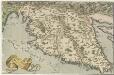
Histriae tabula
1 : 400000 Mollova mapová sbírka Coppo, Pietro Ortelius, Abraham
Umgebungen von Arbe
Kroatien Dalmatien Rab Umland
Istrien
1 : 80000 Cres (Chorvatsko) Oesterreicher, T. Hydrographisches Amt der K. u. k. Kriegs-Marine, Seekarten-Depot
Veglia und Novi.
from Spezialkarte der osterreichisch-ungarischen Monarchie.
Lussinpiccolo und Punta Loni.
from Spezialkarte der osterreichisch-ungarischen Monarchie.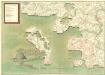
Desegno Di Zeng
Mollova mapová sbírka Geyer
Senj und Otocac.
from Spezialkarte der osterreichisch-ungarischen Monarchie.
Pola und Lubenizze.
from Spezialkarte der osterreichisch-ungarischen Monarchie.
Generalkarte von Zentraleuropa

Die adriatische Küste von Pola bis Zara
1 : 900000 Kroatien Adriaküste
Istrie
1 : 750000 Machát, František c. a k. voj. zeměpisný ústav
Grenzgebiet von Zagrabiensis und Corbaviensis
1 : 1850000 Diözese Krbava, Diözese Zagreb, Grenze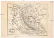
Ostrovy Quarnerské a Velebit
1 : 913000 Dalmácie (Chorvatsko)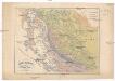
Ostrovy Quarnerské a Velebit
1 : 913000 Dalmácie (Chorvatsko)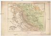
Ostrovy Quarnerské a Velebit
1 : 913000 Dalmácie (Chorvatsko)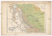
Ostrovy Quarnerské a Velebit
1 : 913000 Dalmácie (Chorvatsko)
Oesterreichische Riviera

Carta del litorale Austriaco
Istrijský poloostrov (Slovinsko a Chorvatsko) Schwarzer von Heldenstamm, Ernst
Karte des k. k. Küstenlandes
Chorvatsko Kettner, Vinzenz Förster, L.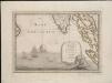
Lo Stato Veneto da terra diviso nelle sue provincie, quarta parte che compren de porzioni del Dogado e dell' Istria.
1 : 536000