Maps of Vosges

Sect. 22: Strassburg i/E, uit: Geologische Karte des Deutschen Reichs in 27 Blaettern / [von] Richard Lepsius ; Red. von C. Vogel
1 : 500000 Annotatie: Blad 18 ontbreekt; Een aantal bladen op linnen; Een aantal bladen gereviseerd 1913-1914; Annotatie geografische gegevens: Met schaalstokken o.a. in kilometers; Legenda Carl Vogel 1828-1897 Gotha : Justus Perthes
Composite 6: Carte de France.
1 : 86400 Cassini family; Cassini, Cesar-Francois, 1714-1784
Lotharingiæ et utriusque Alsatiæ in ditiones minores divisarum tractibusque insertis et finitimis circumscriptarum
1 Karte : Kupferdruck ; 49 x 57 cm Danckerts Danckerts
Lotharingiae et utriusque Alsatiae in ditiones minores divisarum tractibusque insertis et finitimis circumscriptarum novissima nitidissima, et accuratissima delineatio
1 : 540000 1 Karte : Kupferdruck ; 48 x 56 cm Danckerts, Theodorus [Danckerts]
Carte de la France, no. 6
1 Blatt : 60 x 81 cm s.n.
Geographica Sueviæ universæ descriptio, 1
1 Blatt : Homännische Erben
Elsass-Lothringen, Bayerische Pfalz.
1 : 870000 Andree, Richard
Abris Des Rheinstroms
Mollova mapová sbírka

Lotharingiae et Utriusque Alsatiae in Ditiones Minores Divisarum Tractibusque Insertis et Finitimis Circumscriptarum Novissima nitidissima et Accuratissima
1 : 550000 Mollova mapová sbírka Danckerts, Theodorus
Les duchez de Lorraine et de Bar
1 Karte : Kupferdruck ; 46 x 60 cm Nolin; Du Tralage chez I. B. Nolin sur le quay de l'Horloge du Palais à l'enseigne de la place des Victoires vers le Pont Neuf
Der Rheinstrohm von Basel bis Maynz
1 : 620000 Basilej (Švýcarsko) Engelman, J.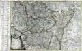
Carte du théatre de la guerre dans les départemens des Voges
1 Karte auf 2 Blättern : Kupferdruck ; 48 x 69 cm Basset; Chaumier; Basset chez Basset rue St. Jacques au coin de celle des Mathurins, et chez les m.ds d'estampes de ces cinq départemens
Charte des Rhein-Stroms von Breisach bis Linz auch als Post- u. Reise-Charte der umliegenden Länder brauchbar
1 : 617000 Breisach am Rhein (Německo) Streit, Friedrich Wilhelm Joseph Engelmann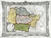
Carte des départemens de la Meuse, de la Moselle, de la Meurte, des Vôges, et du Bas Rhin
1 Karte : Kupferdruck ; 23 x 34 cm, Bildgrösse 32 x 42 cm Desnos; Starckman chez le S. Desnos rue St. Jacques au globe
La Lorraine qui comprend les duches de Lorraine et de Bar et de balliages des evesches et de villes de Metz, Toul et Verdun
1 Karte : Kupferdruck ; 43 x 47 cm verlegt bey Adam Ionathan Felseckern seel Erben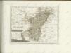

Le duché de Lorraine duché de Bar duché de Deux Ponts presidial de Verdun pays Messin Haute Alsace
1 Karte : Kupferdruck ; 49 x 62 cm Crépy; Crépy chez Crepy ruë S. Jacques a S. Pierre
Western Front from Argonne to Vosges
1 : 250000 First World War map of the Western Front from Argonne to Vosges. 1918. War Office
Exactissima totius Mosellae et Sarae fluvii tabula
1 : 411000 Lotrinsko (Francie) Danckertsz, Cornelis per Cornelium Danckerts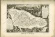

Carte de la Lorraine
1 : 500000 Alsasko (Francie) Delamarche, Charles Francois C. F. Delamarche
Germania Prima sive Superior cujus Metropolis Moguntiacum
1 : 875000 Mollova mapová sbírka Sanson, Guillaume Sanson, Guillaume
Exactissima Totius Mosellae et Sarae Fluvii Tabula et Minorum in eum influentisim Cum Omnibus Adiacentibus Regionibus
1 : 430000 Mollova mapová sbírka Danckerts, Cornelis Danckerts, Cornelis
Karte vom Kriegestheater der vereinigten preussischen und östreichischen Armeen in Frankreich in VI. Blättern, [Blatt 6, 9 und 12]
3 Teile auf 3 Blättern : 72 x 39 cm Königl. preuss. Akademische Kunst- und Buchhandlung
Exactissima Lotharingia tam regis Gallorum quam Ducis Caroli
1 : 450000 opera Caroli Allard Amsterdam : gedruckt by Carel Allardt
Frontiere Franco-Allemande
1 : 320000 Francie
Karte der Reichs-Provinz Elsass-Lothringen
1 : 400000 Alsasko (Francie) R. Schultz & Comp.

![Sect. 22: Strassburg i/E, uit: Geologische Karte des Deutschen Reichs in 27 Blaettern / [von] Richard Lepsius ; Red. von C. Vogel](https://images-0.georeferencer.com/images/iiif/410827385335/full/,300/0/native.jpg)

