Maps of Mediterranean Sea
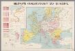
Nieuwste oorlogskaart van Europa
1 : 6000000 A[mster]dam : Meulenhoff
Österreich-Ungarn und Bosnien-Hercegovina
Eberle, Joseph

Europa temporibus expeditionum sacrarum
Evropa Kunst u geogr. Anstalt von Serz & C.ie
Paasche's Frontenkarte, Nr. 11 Europäische Kriegsschauplätze

Invasion des Barbares.
Andriveau-Goujon, J.
Carte d'Europe indiquant le canal maritime de l'océan à la Méditerranée
1 : 16000000 Perrin, Maurice [Paris] : [éditeur inconnu]
Eisenbahn- Post- und Dampfschiffahrts-Karte von Europa
1 : 8000000 Evropa Denk, L. Lith. Anst. v. L. Mohn's Witwe
23. Europa im 17. und 18. Jahrhundert (1740)
1 : 15000000 Europa
Europe Centrale en 1920
1 : 4200000 titelvariant: Nouvelle carte de l'Europe Centrale; Annotatie: Titel linksboven: Nouvelle carte de l'Europe Centrale Paris : Taride
20. Europa im 16. Jahrhundert (1559)
1 : 15000000 Europa
Europa 1964
Europa Kunz, Andreas ; Moeschl, Joachim Robert
Europa im 17. und 18. Jahrhundert (1740)
1 : 15000000 Europa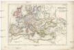
Europa zur Zeit Carl's V
Evropa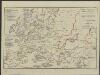
[Hierographie, oder topographisch-synchronistische Darstellung der Geschichte der christlichen Kirche] : X. Von Gregor VII bis zu den Päpsten in Avignon 1073-1305
1 : 8400000 W.A. Möller Lith. bey Arnz & Co. in Düsseldorf Elberfeld : Büschler
Europa 1993
Europa Kunz, Andreas ; Moeschl, Joachim Robert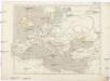
Die nach der Völkervanderung entstandenen neuen Reiche
Evropa
[Historisch-geographischer Atlas zu den allgemeinen Geschichtswerken von C. v. Rotteck, Pölitz u. Becker] : Die Völkerwanderung nach ihren Ausgangspunkten, Zügen und Niederlassungen
von Julius Loewenberg Lithographie von B. Herder in Freiburg im Breisgau [Freiburg im Breisgau] : [Herder]
Europa 6.8.1806
Europa Kunz, Andreas ; Moeschl, Joachim Robert
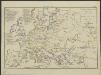
Physische Karte von Europa
Schul-Atlas über alle Theile der Erde nach dem neuesten Zustande, und über das Weltgebäude Stieler, Adolf Justus Perthes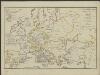
[Hierographie, oder topographisch-synchronistische Darstellung der Geschichte der christlichen Kirche] : XII. Von den Päpsten in Avignon bis zur Reformation J. 1305-1517
1 : 8400000 W.A. Möller Lith. bey Arnz & Co. in Düsseldorf Elberfeld : Büschler
[Hierographie, oder topographisch-synchronistische Darstellung der Geschichte der christlichen Kirche] : IX. Von Gregor VII bis zu den Paepsten von Avignon 1073-1305
1 : 8400000 W.A. Möller Lith. bey Arnz & Co. in Düsseldorf Elberfeld : Büschler
Europa 1820
Europa Kunz, Andreas ; Röss, Wolf ; Moeschl, Joachim Robert
Europa 1908
Europa Kunz, Andreas ; Röss, Wolf ; Moeschl, Joachim Robert
Europa 1975
Europa Kunz, Andreas ; Moeschl, Joachim Robert
Europa 2007
Europa Kunz, Andreas ; Moeschl, Joachim Robert
Europa 1772
Europa Kunz, Andreas ; Moeschl, Joachim Robert
Europa 1929
Europa Kunz, Andreas ; Moeschl, Joachim Robert
Europa 1937
Europa Kunz, Andreas ; Moeschl, Joachim Robert