Maps of Limburg
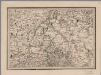
[19], uit: Hydro-Oro und Chorographische General Karte des Koenigreichs der Niederlande und der angrenzenden Länder bis Paris : mit der Angabe der Kunst und Heer-Strassen und der Entfernung der Poststationen / ... zusammengetragen und reducirt von ... Wilhelm Müller
1 : 400000 titelvariant: Generalkarte des Koenigreichs Hannover; Annotatie: 1e supplement bij: Generalkarte des Koenigreichs Hannover (1818) Müller, Wilhelm (fl. 1818) [Hannover : Wilhelm Müller]
Le Duché de Luxembourg divisé en Quartier Walon, et Allemand
1 : 140000 Mollova mapová sbírka Jaillot, Alexis-Hubert Jaillot, Alexis Hubert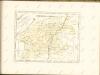

Archiepiscopatus et electoratus Coloniensis ut et ducatuum Iuliacensis et Montensis nec non comitatus Meursiae nova tabula
1 : 317000 Kolín nad Rýnem-oblast (Německo) excudente Iohan. Baptista Homanno
Archiepiscopatus et electoratus Coloniensis ut et ducatuum Iuliacensis et Montensis nec non comitatus Meursiae nova tabula
1 : 317000 Kolín nad Rýnem-oblast (Německo) excudente Iohan. Baptista Homanno
Archiepiscopatus et electoratus Coloniensis ut et ducatuum Iuliacensis et Montensis nec non comitatus Meursiae nova tabula
1 : 317000 Kolín nad Rýnem-oblast (Německo) excudente Iohan. Baptista Homanno
Limburg, uit: Sterfte-atlas van Nederland over 1860-1874 / [uitgave van de Nederlandsche Maatschappij tot Bevordering der Geneeskunst]
titelvariant: Sterfte-atlas van Nederland; Annotatie: Alleen kaartbijlage aanwezig Pieter Harmen Witkamp 1816-1892; Nederlandsche Maatschappij tot Bevordering der Geneeskunst Amsterdam : van Rossen
[Kaart], uit: Sleeswijk's kaart van Limburg : naar officieële gegevens bewerkt voor wandelaars, wielrijders en automobilisten, voor school, kantoor en huiskamer : met nauwkeurige afstandsbepalingen in kilometers tusschen de plaatsen
1 : 150000 titelvariant: Limburg; Annotatie: Omslagtitel; Tweede titel boven de kaart: Limburg; In verso: plaatsnamenregister; Annotatie geografische gegevens: Schaalstok; Legenda J.A. Sleeswijk, Bussum; J. Smulders & Co., 's-Gravenhage Bussum : J.A. Sleeswijk / (Lith. J. Smulders & Co., Den Haag)
Limburgensis ducatus tabula nova
1 : 180000 Aegidius Martini ... fecit et dedicavit anno 1603. [Antwerpen] : excusa sumptibus Joan. Baptistae Vrints, aemuli studii geographi
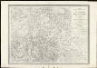
Tabula ducatus Brabantiae continens marchionatum Sacri Imperii et dominium Mechliniense
1 : 320000 Brabantsko Wit, Frederick de F. de Wit
Le Limbourg, ou sont Le Duché De Limbourg Le Comté De Dalem; Les Seigneuries De Fauquemont Et De Rolduc [Karte], in: Atlas nouveau, contenant toutes les parties du monde [...], Bd. 2, S. 36.
1 Karte aus Atlas Sanson, Nicolas Jaillot, Alexis Hubert und Mortier, Pieter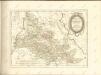
Vervolg der kaart van de grensscheiding tusschen het oud-Nederland en de Belgische provincien
1 : 100000 onder de directie en volgens het Topografisch sijstema van ... J.E. van Gorkum letter gegrav. door J.M. Huart ; situatie gegrav. door A. Bayly. [S.l.] : [s.n.]
Le Limbourg ou sont le Duché de Limbourg, le Comté de Dalem, les Seigneuries de Fauquemont et de Rolduc : dressé sur les mémoires le pl[u]s recents
1 : 185000 par le Sr. Sanson. A Amsterdam : chez R. & J. Ottens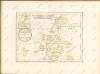
27. Limburg, uit: Geologische kaart van Nederland : schaal van 1:200.000 / door W.C.H. Staring ; uitgevoerd door het Topographisch Bureau van Oorlog ; uitgegeven op last van Zijne Majesteit Den Koning
Annotatie: Impressum ontleend aan omslag; Kaart "Nederland de dijken weggedacht" [kaart 25] en kaart 13 (bladwijzer) vermelden het jaar 1869; Kaart 'Limburg en de Hesbaije' (bladnr. 26) vermeldt het jaar 1868; Blad 5/9 ontbreekt Topographische Inrichting, 's-Gravenhage; Topographisch Bureau Haarlem : A.C. Kruseman
19, uit: Topografische atlas van het Koninkrijk der Nederlanden
Annotatie: Map met 19 losse krt. schaal 1:200.000 en 1 bladwijzer schaal 1:1.000.000 ['s-Gravenhage : Ministerie van Oorlog, Topografisch Bureau]
27. Limburg, uit: Geologische kaart van Nederland / door W.C.H. Staring ; bew. aan de Topographische Inrichting
1 : 200000 Winand Carel Hugo Staring 1808-1877; Topographische Inrichting, 's-Gravenhage 's-Gravenhage : Belinfante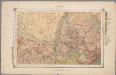
27. Limburg, uit: Geologische kaart van Nederland / door W.C.H. Staring ; bew. aan de Topographische Inrichting
1 : 200000 Winand Carel Hugo Staring 1808-1877; Topographische Inrichting, 's-Gravenhage 's-Gravenhage : Belinfante
26. Limburg : Limburg en de Hesbaije, uit: Geologische kaart van Nederland / door W.C.H. Staring ; bew. aan de Topographische Inrichting
1 : 200000 Winand Carel Hugo Staring 1808-1877; Topographische Inrichting, 's-Gravenhage 's-Gravenhage : Belinfante
Ducatus Limburgum [Karte], in: Novus atlas absolutissimus, Bd. 3, S. 67.
1 Karte aus Atlas Janssonius Offizin
Ducatus Limburgum [Karte], in: Novus Atlas, das ist, Weltbeschreibung, Bd. 1, S. 336.
1 Karte aus Atlas Blaeu, Joan Blaeu, Willem Janszoon
Ducatus Limburgum [Karte], in: Theatrum orbis terrarum, sive, Atlas novus, Bd. 1, S. 357.
1 Karte aus Atlas Blaeu, Joan Blaeu, Willem Janszoon
Ducatus Limburg. [Karte], in: Gerardi Mercatoris et I. Hondii Newer Atlas, oder, Grosses Weltbuch, Bd. 1, S. 401.
1 Karte aus Atlas Mercator, Gerhard und Hondius, Jodocus Jansson, Jan
X, uit: Carte chorographique des Pays-Bas Autrichiens / ... par le Comte de Ferraris ; gravée par L.A. Dupuis
1 : 86400 Annotatie: Lit.: Les militaires et la cartographie des Pays-Bas méridionaux et de la Principauté de Liège à la fin du XVIIe et au XVIII siècle / Claire Lemoine-Isabeau. - Bruxelles, 1984, p. 206-212; La cartographie au XVIIIe siècle et l'oeuvre du Comte de Ferraris (1726-1814) : colloque international, Spa, 8-11 sept. 1976. - Bruxelles, 1978; Met opdracht aan keizer Joseph II (bl.XVI); Met plattegrond van Brussel (bl. XXI), overzichtskaart (bl. XXII) en bladwijzer (bl. XXIII); Ontbreekt: bl. I-III en XXI; Voor aanwezige bladen zie overzichtsblad Ferraris, Johann Joseph; Dupuis, L. A. [S.l. : s.n.]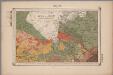
26. Limburg : Limburg en de Hesbaije, uit: Geologische kaart van Nederland : schaal van 1:200.000 / door W.C.H. Staring ; uitgevoerd door het Topographisch Bureau van Oorlog ; uitgegeven op last van Zijne Majesteit Den Koning
Annotatie: Impressum ontleend aan omslag; Kaart "Nederland de dijken weggedacht" [kaart 25] en kaart 13 (bladwijzer) vermelden het jaar 1869; Kaart 'Limburg en de Hesbaije' (bladnr. 26) vermeldt het jaar 1868; Blad 5/9 ontbreekt Topographische Inrichting, 's-Gravenhage; Topographisch Bureau Haarlem : A.C. Kruseman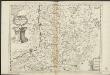
Ducea di Limburgo
1 : 200000 [Vincenzo Coronelli] [S.l.] : [s.n.]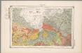
26. Limburg : Limburg en de Hesbaije, uit: Geologische kaart van Nederland / door W.C.H. Staring ; bew. aan de Topographische Inrichting
1 : 200000 Winand Carel Hugo Staring 1808-1877; Topographische Inrichting, 's-Gravenhage 's-Gravenhage : Belinfante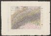
Ducatus Limburgum [Karte], in: Le théâtre du monde, ou, Nouvel atlas contenant les chartes et descriptions de tous les païs de la terre, Bd. 1, S. 363.
1 Karte aus Atlas Blaeu, Willem Janszoon und Blaeu, Joan Blaeu, Willem Janszoon
![[19], uit: Hydro-Oro und Chorographische General Karte des Koenigreichs der Niederlande und der angrenzenden Länder bis Paris : mit der Angabe der Kunst und Heer-Strassen und der Entfernung der Poststationen / ... zusammengetragen und reducirt von ... Wilhelm Müller](https://images-2.georeferencer.com/images/iiif/368565491929/full/,300/0/native.jpg)

