Maps of Pas-de-Calais
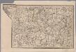
[17], uit: Hydro-Oro und Chorographische General Karte des Koenigreichs der Niederlande und der angrenzenden Länder bis Paris : mit der Angabe der Kunst und Heer-Strassen und der Entfernung der Poststationen / ... zusammengetragen und reducirt von ... Wilhelm Müller
1 : 400000 titelvariant: Generalkarte des Koenigreichs Hannover; Annotatie: 1e supplement bij: Generalkarte des Koenigreichs Hannover (1818) Müller, Wilhelm (fl. 1818) [Hannover : Wilhelm Müller]
La Flandre Françoise
1 : 250000 dressée sur les Memoires les plus nouveaux par le Sr. Sanson A Paris : chez H. Jaillot, joignant les grands Augustins aux 2 globes
La Flandre Françoise, dreßée sur les Memoires les plus nouueaux
1 : 250000 Mollova mapová sbírka Sanson, Nicolas Jaillot, Alexis Hubert
Die Grafschaft Flandern
1 : 1110000 Flandry Bodenehr, Gabriel Gabriel Bodenehr
Fiandra Parte Occidentale
1 : 300000 Mollova mapová sbírka Coronelli, Vincenzo Maria Padoani, Domenico
Fiandra Parte Occidentale
1 : 300000 Mollova mapová sbírka Coronelli, Vincenzo Maria Padoani, Domenico
Le Comté De Flandre Devisé En Ses Chastellenies et Balliages, &c. Le Franc De Bruges et Le Pays De Waes Dedié Au Roy [Karte], in: Atlas nouveau, contenant toutes les parties du monde [...], Bd. 2, S. 50.
1 Karte aus Atlas Sanson, Nicolas Jaillot, Alexis Hubert und Mortier, Pieter
Le Comté de Flandres divisé en ses Chastellenies, Balliages, &c.
1 : 150000 Mollova mapová sbírka Jaillot, Alexis-Hubert Jaillot, Alexis Hubert
Flandria Maximus et Pulcherrimus Europae Comitatus, in suas Ditiones accurate distinctus
1 : 300000 Mollova mapová sbírka Seutter, Matthäus
Comitatus Flandriae Descriptio per Observationes Astronomicas Academiae Regiae Scientiarum quae est Parisiis
1 : 250000 Mollova mapová sbírka Wolf, Jeremias Wolff, Jeremias
A Map of the County of Flanders
1 : 250000 Mollova mapová sbírka Delisle, Guillaume Senex, John
Le Comté de Flandre
1 : 333000 Mollova mapová sbírka Placide de Sainte-Hélène
Flandria maximus et pulcherrimus Europæ comitatus
1 Karte : Kupferdruck ; 48 x 56 cm Seutter M. Seutter
L'Artois le Boulenois et Picardie
1 Karte : Kupferdruck ; 51 x 70 cm Crépy chez Crepy rue St. Jacques a St. Jacques
Flandriae Comitatus in ejusdem subjacentes Ditiones Accuratissimé divisus una cum Adjacentibus cum privil: ord: gen: belgii fœderati
1 : 300000 Mollova mapová sbírka Visscher, Nicolaes Jansz. Gouwen, Giliam van der Schenk, Peter II
Comitatus Flandriae
1 : 300000 Mollova mapová sbírka Homann, Johann Baptist Homann, Johann Baptista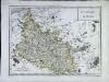
Gouvernement d'Artois
1 Karte : Kupferdruck ; 31 x 42 cm Mentelle; Tardieu; Dubuisson Mentelle
Comitatus Artesiæ et Flandriæ meridionalis et regionum circumjacentium nova descriptio
1 Karte : Kupferdruck ; 48 x 59 cm L'Isle; Ottens; Ottens; Fricx R. et J. Ottens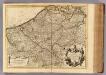
Comte de Flandre.
1 : 235000 L'Isle, Guillaume de, 1675-1726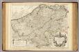
Comte de Flandre.
1 : 235000 L'Isle, Guillaume de, 1675-1726
Novissima Flandriae Comitatus Tabula cum Omnibus Praefecturis, etc. et suis Adjacentibus Provinciis
1 : 300000 Mollova mapová sbírka Keulen, Gerard van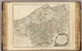
Flandre.
1 : 258000 Robert de Vaugondy, Gilles, 1688-1766
Artesiae Comitatus, Completens proprii Comitatus nomine Fanum S. Pauli: Baliviatus S. Audomari, Ariensem, Bethunensem, Lentiacensem, Atrebatensem Hesdiniensem, Bapolmensem, Aubigniensem, Aveniensem, et Dominium Teruanense, Eosque circumjacentes Provincias: accurant:
1 : 260000 Mollova mapová sbírka Valk, Gerhard Valck, Gerard
Comitatus Flandriae descripto
1 : 315000 Flandry Delisle, Guillaume Lotter, Tobias Conrad T. C. Lotter
Carte du Comté de Flandre
1 : 250000 Mollova mapová sbírka Delisle, Guillaume Liébaux L'Isle, Guillaume de
Pars Flandriae Teutonicae Occidentalior. [Karte], in: Le théâtre du monde, ou, Nouvel atlas contenant les chartes et descriptions de tous les païs de la terre, Bd. 1, S. 388.
1 Karte aus Atlas Blaeu, Willem Janszoon und Blaeu, Joan Blaeu, Willem Janszoon
Carte d'Artois et des Environs
1 : 250000 Mollova mapová sbírka Delisle, Guillaume Homann, Johann Baptista - dědici
Carte d'Artois et des Environs
1 : 116000 Mollova mapová sbírka Delisle, Guillaume Covens, Johannes I
The Province of Artois and the Country Adjacent
1 : 250000 Mollova mapová sbírka Delisle, Guillaume Senex, John L'Isle, Guillaume de
![[17], uit: Hydro-Oro und Chorographische General Karte des Koenigreichs der Niederlande und der angrenzenden Länder bis Paris : mit der Angabe der Kunst und Heer-Strassen und der Entfernung der Poststationen / ... zusammengetragen und reducirt von ... Wilhelm Müller](https://images-2.georeferencer.com/images/iiif/485572406375/full/,300/0/native.jpg)

