Maps of Columbia Mountains

Washington, Mt. Rainier National Park : topography / R.B. Marshall, chief geographer ; T.G. Gerdine, geographer in charge ; topography by F.E. Matthes ... [et al.] ; engraved by U.S.G.S.
1 : 62500 Annotatie geografische gegevens: Opname: 1910-1911, 1913 Marshall, R. B.; Gerdine, T. G.; Matthes, François E.; United States Geological Survey [Washington, D.C. : U.S. Geological Survey]
U.S. West of Mississippi R. 1.
1 : 2000000 Freyhold, Edward; Warren, Gouverneur Kemble, 1830-1882; United States. Army. Corps of Engineers
Pacific Coast subjects.
1 : 7800000 United States. Census Office
Washington, Oregon, California, Idaho.
1 : 1518000 Rand McNally and Company
Oregon and Washington.
1 : 2550000 Johnson, A.J.
Oregon and Washington.
1 : 2550000 Johnson, A.J.
Oregon and Washington.
1 : 2515000 Gray, Ormando Willis
Rand McNally Official 1925 Auto Trails Map Washington Oregon.
1 : 1077120 Rand McNally and Company
Oregon, Washington.
1 : 1750000 Mitchell, Samuel Augustus
Oregon, and the Territory of Washington.
1 : 3000000 Lloyd, H.H.
Oregon, and the Territory of Washington.
1 : 3000000 Walling, H. F.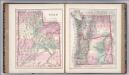
Utah. Oregon and Washington.
1 : 1584000 Gray, Ormando Willis
Oregon and Washington.
1 : 2550000 Johnson, A.J.
California and Nevada. North Portion.
1 : 1290000 Asher & Adams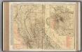
California (Northern Section).
1 : 1140000 Rand McNally and Company
Oregon.
1 : 1280000 Asher & Adams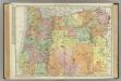
Oregon.
1 : 1014000 Rand McNally and Company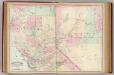
Calif., Nev. north.
1 : 1267200 Asher & Adams
Oregon agric., farm values, products, acreages.
1 : 1950000 Cram, George Franklin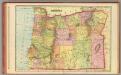
Oregon.
1 : 1490000 Cram, George Franklin; Davis, Ellis Arthur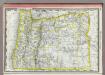
Oregon.
1 : 1485000 Rand McNally and Company
Map of the Gold Regions of the Frazer River and the Washington Territory on the Western Coast of America. By J. Wyld
Map of the Gold Regions of the Frazer River and the Washington Territory on the Western Coast of America. By J. Wyld. London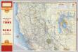
Shell Highway Map of California (northern portion).
1 : 1330560 Shell Oil Company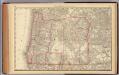
Oregon.
1 : 1900000 Rand McNally and Company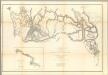
Rocky Mountains to Puget Sound.
1 : 1200000 Stevens, Isaac I.
Rand McNally Official 1925 Auto Trails Map British Colombia.
1 : 1077120 Rand McNally and Company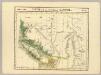
Partie, Nouvelle Hanovre. Amer. Sep. 31.
1 : 1641836 Vandermaelen, Philippe, 1795-1869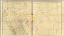
California, Nevada (upper)
1 : 696960 Von Haake, A.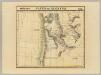
Partie des Etats Unis. Amer. Sep. 38.
1 : 1641836 Vandermaelen, Philippe, 1795-1869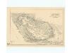
![Washington, Mt. Rainier National Park : topography / R.B. Marshall, chief geographer ; T.G. Gerdine, geographer in charge ; topography by F.E. Matthes ... [et al.] ; engraved by U.S.G.S.](https://images-2.georeferencer.com/images/iiif/714186066963/full/,300/0/native.jpg)

