Maps of Alaska
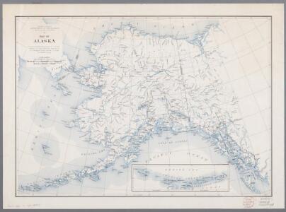
Map of Alaska
1 : 5000000 [Washington, D.C. : United States Department of the Interior, Geological Survey]
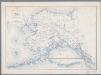
Map of Alaska / comp. by Alaska Branch
1 : 5000000 United States Geological Survey. Alaskan Branch [Washington, D.C. : U.S. Geological Survey]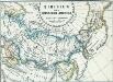
Sibirien und Russisch Amerika
1 : 70000000 Sibirien, Russisch-Amerika
Nord Pol.
1 : 32000000 Meyer, Joseph, 1796-1856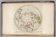
North Pole countries.
1 : 40000000 Carey, Mathew
North Pole countries.
1 : 40000000 Carey, Mathew
Countries situate about the North Pole.
1 : 41000000 Carey, Mathew
Map of the Countries situate about the North Pole.
1 : 40000000 Carey, Mathew
Map of the Countries situate about the North Pole.
1 : 40000000 Carey, Mathew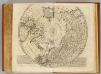
North Pole.
1 : 21500000 Bowen, Emanuel
Scandinavia.
1 : 3300000 Thomson, John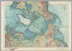
Arctic. Pergamon World Atlas.
1 : 20000000 Polish Army Topography Service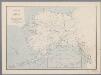
Map of Alaska
1 : 5000000 [Washington, D.C. : U.S. Geological Survey]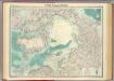
North Polar regions.
1 : 14000000 John Bartholomew and Son
Alaska.
1 : 8200000 Rand McNally and Company
Territory of Alaska.
1 : 7500000 Colton, G.W.
Behring's Sea and Arctic Ocean : from surveys of the U.S. North Pacific Surveying Expedition in 1855, Commander John Rodgers U.S.N. commanding and from Russian and English authorities
1 : 4400000 United States. Hydrographic Office U.S. Navy, Hydrographic Office
Polar-Karte
1 : 27000000 Arktida Stieler, Adolf Justus Perthes
Map of the countries round the North Pole
1 : 15000000 Arktida Arrowsmith, John John Arrowsmith
A new [and] accurate map of the North Pole
1 Karte : Kupferdruck ; 37 x 40 cm Bowen s.n.
Poli arctici, et circumiacentium terrarum descriptio novissima
1 Karte : Kupferdruck ; Durchmesser 43 cm, Bildgrösse 43 x 49 cm Wit Louis Renard
Nova et accvrata poli arctici et terrarum circum iacentium descriptio
1 Karte : Kupferdruck ; 40 x 52 cm Janssonius apud Ioannem Ianssonium
Nova et accvrata poli arctici et terrarum circum iacentium descriptio
1 Karte : Kupferdruck ; 39 x 51 cm Valck; Schenk apud Gerardi Valk et Petri Schenk
Poli arctici, et circumiacentium terrarum descriptio novissima
1 Karte : Kupferdruck ; Durchmesser 42 cm, Bildgrösse 43 x 49 cm Wit by Frederick de Wit in de Calverstraet aen den Dam in de Witte Pascaert
Regiones svb polo arctico
1 Karte : Kupferdruck ; 40 x 52 cm Blaeu Blaeu
Northern Regions.
1 : 22176000 Colton, G.W.
The Arctic regions
1 : 14673400 Arktida National Geographic Society
North Polar Regions.
1 : 22000000 Rand McNally and Company
North America...N.W. Sheet.
1 : 7500000 Tanner, Henry S.