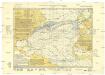
Maps of North Atlantic Ocean

Nord-Atlantischer Ocean
Hand-Atlas über alle Theile der Erde und über das Weltgebäude Stieler, Adolf Justus Perthes
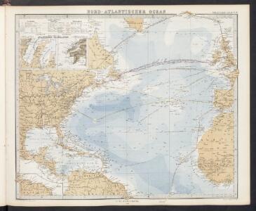
Nord-Atlantischer Ocean
Handatlas über alle Theile der Erde und über das Weltgebäude Stieler, Adolf Justus Perthes
Mar del Nort / [Joannes Janssonius]
1 : 30000000 Annotatie: Origineel is Blad 3 in atlas factice Janssonius, Joannes (jr.) (1588-1664) [Amsterdam : Joannes Janssonius]
Mar Del Nort. [Karte], in: Het vijfde Deel Des Grooten Atlas : Vervatende De Water-Weereld, S. 56.
1 Karte aus Atlas Jansson, Jan Jansson, Jan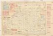
Pilot chart of the North Atlantic Ocean
1 : 14300000 Atlantský oceán (oblast) Maury, Matthew Fontaine Hydrographic Office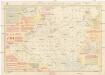
Pilot chart of the North Atlantic Ocean
1 : 14300000 Atlantský oceán (oblast) Maury, Matthew Fontaine Hydrographic Office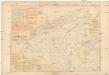
Pilot chart of the North Atlantic Ocean
1 : 14300000 Atlantský oceán (oblast) Maury, Matthew Fontaine Hydrographic Office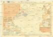
Pilot chart of the North Atlantic Ocean
1 : 11300000 Atlantský oceán (oblast) Hydrographic Office
Mar Del Nort. [Karte], in: Novus atlas absolutissimus, Bd. 9, S. 58.
1 Karte aus Atlas Janssonius Offizin
Mar del nort
1 : 30000000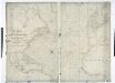
A chart of the Atlantic or Western Ocean / drawn from the latest surveys & astronomical observations by J. & A. Walker, London & Liverpool 1830.
from Atlantic Ocean J. & A. Walker,
A new map or chart in Mercators projection, of the Western or Atlantic Ocean, with part of Europe, Africa and America
1 : 18000000
North Atlantic Ocean.
1 : 8000000 Blunt, Edmund M. (Edmund March), 1770-1862
Meteorological chart of the North Atlantic Ocean
1 : 13700000 Atlantský oceán (oblast) Secretary of Agriculture
Meteorological chart of the North Atlantic Ocean
1 : 13700000 Atlantský oceán (oblast) Secretary of Agriculture
A new map or chart in Mercators projection of the Western or Atlantic Ocean: with part of Europe, Africa and America.
from Atlantic Ocean J. (John) Bew?: [London],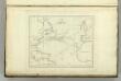
Chart of the Atlantic Ocean.
1 : 35000000 Melish, John
Carte de l'ocean Atlantique
1 Karte : Kupferdruck ; 47 x 61 cm Jefferys; Le Rouge chez Le Rouge rue des g.ds Augustins
Carte de l'océan Atlantique
1 Karte : Kupferdruck ; 48 x 61 cm Lattré chéz Lattré graveur du roy rue St. Jacques la porte cochère vis avis la rue de la Parcheminerie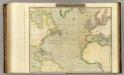
N. Atlantic Ocean.
1 : 22500000 Thomson, John
General chart, of the North Atlantic, or Western Ocean, from the equator to 62° north latitude, according to the latest, surveys and observations
1 : 9000000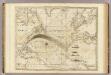
The Atlantic Ocean.
1 : 22500000 Pownall, Thomas
A new generall chart for the West Indies....
from English pilot. The fourth book.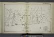
Part of Brookhaven Suffolk County
from Atlas of ... Suffolk County, Long Island, New York ... : based upon actual measurements by our own corps of engineers, maps on file at county offices, also maps from actual surveys furnished by individual owners / under the supervision of Merritt B. Hyde.
New Jersey / engraved by J.H. Young.
from Whole
Der Atlantische Ocean
Hand-Atlas über alle Theile der Erde nach dem neuesten Zustande und über das Weltgebäude Stieler, Adolf bei Justus Perthes
Karte des Atlantischen Oceans
1 Karte : Kupferdruck ; 48 x 60 cm Schrämbl zu finden in eigenem Verlage Schrämbl
X. August and September Hurricane of 1848
Maury, Matthew Fontaine
Chart of the Atlantic Ocean.
1 : 43000000 Melish, John