Maps of Dinaric Alps

[Die Balkan-Halbinsel, Blatt 1]
Adolf Stieler's Handatlas über alle Theile der Erde und über das Weltgebäude Stieler, Adolf Justus Perthes
Die unterentwickelten Gemeinden in Jugoslwaien (schraffiert gekennzeichnet)
Jugoslawien Wirtschaftsentwicklung
De Balkan (Noord-West)
1 : 3400000 Den Haag : Kompas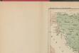
Les Serbes, les Croates et les Slovènes parmi les nations-voisines
Serbien Kroatien
Le pays des Serbes, des Croates et des Slovenes
Jugoslawien Physische Geografie
Státy Balkánské

Übersichtskarte des südlichen Kriegsschauplatzes
1 : 750000 Rakousko-Uhersko k. u. k. Hof- und Universitätsbuchhandlung R. Lechner (W. Müller)
Österreichisch-Ungarisch=Serbischer Kriegsschauplatz
Langhans, Paul
Historische Regionen des Königreichs SHS
Kraljevina Srba, Hrvata i Slovenaca Džambo, Jozo
Balkan
Balkanhalbinsel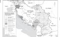
Besetzung und territoriale Aufteilung Jugoslawiens im Zweiten Weltkrieg
1 : 2500000 Jugoslawien Besetzung, Weltkrieg <1939-1945> Clewing, Konrad ; John, Holger W.
Überfall, Besatzung und Teilung Jugoslawiens 1941
Jugoslawien Balkanfeldzug <1941>, Besetzung
Artaria ́s Handkarte des Königreiches der Serben, Kroaten und Slovenen

[Zemlě u koima prebivaju Srbjui]
Makedonien Ethnische Gruppe Serben
SFR Jugoslawien 1945-1991
Jugoslawien Džambo, Jozo
Die administrative Einteilung des Königreiches Jugoslawien nach Banschaften/banovine (ab 1929)
1 : 2500000 Jugoslawien Verwaltungsgliederung Clewing, Konrad ; John, Holger W.
Velika zidna karta Srba, Hrvata i Slovenaca

Dialectes de la Macédoine d'après A. Belitch
Makedonien Bulgarisch Mundart Serbisch Th. Weinreb del.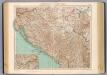
77-78. Jugoslavia.
1 : 1500000 Touring club italiano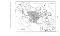
Politische Aufteilung des Königreichs SHS auf Gebiete (oblasti) 1922
Kraljevina Srba, Hrvata i Slovenaca Verwaltungsgliederung Džambo, Jozo
Balkan-Halbinsel
Balkánský poloostrov Vogel, Carl Justus Perthes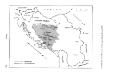
Banschaft Kroatien im Königreich Jugoslawien 1939
Jugoslawien, Kroatische Banschaft Džambo, Jozo
[Belgrad]
1 : 1200000 Bělehrad (Srbsko : oblast) Schlacher, J. R. Lechner
Jugoslawien
Jugoslawien ethnische Gruppe
Übersichts-Karte der serbischen Operationen im Krieg gegen die Türkei
Makedonien Balkankrieg <1912-1913>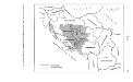
Politische Aufteilung des Königreichs Jugoslawien auf Banschaften 1931
Jugoslawien Verwaltungsgliederung Džambo, Jozo
Serbien und Montenegro nach den Balkankriegen
Serbien, Montenegro, Balkankriege Häusler, Ines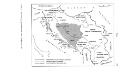
Zerstückelung Jugoslawiens nach der Okkupation 1941
Jugoslawien Balkanfeldzug <1941>, Besetzung Džambo, Jozo
Geološka karta Kraljevine Jugoslavije
1 : 1000000 Jugoslávie Petković, Vladimir Kosta izdanje knjižare Frajne Bacha
![[Die Balkan-Halbinsel, Blatt 1]](https://images-2.georeferencer.com/images/iiif/575578479301/full/,300/0/native.jpg)

