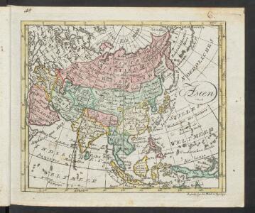
Maps of Asia

Asien
Allgemeiner Atlas [Walch, Johannes] im Verlag bei Johannes Walch
[Recto], uit: Azië / aardrijksk. medew. G.J. de Vries
1 : 58000000 titelvariant: Landen van Azië met de hoofdsteden; Annotatie: Titel boven de kaart: Landen van Azië met de hoofdsteden Vries, Gerben Johannes de Sneek : Tonnema
II. Charte für die allgemeine Geschichte von Troja’s Zerstörung bis auf den Anfang der Perserkriege : d.i. von 1184 bis 501 vor Christus
Entworfen von F.W. Benicken Weimar : im Verlage des L. Industrie-Comptoirs
Asia
Hand-Atlas über alle Theile der Erde und über das Weltgebäude Stieler, Adolf Justus Perthes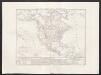
Carta generale dell'America settentrionale
1 : 25000000 Marzolla, Benedetto Real Litografia Militare
N. Hemisphere, plane of London.
1 : 41000000 Thomson, John
Asien
Plastischer Schul-Atlas über alle Theile der Erde : in 24 Karten Woldermann, G Verlag von P. Eckerlein
IV. Charte für die allgemeine Geschichte von Augustus Alleinherrschaft bis auf den Untergang des weströmischen Reichs : d.i. von 30 v. Chr. bis 476 nach Christus
Entworfen von F.W. Benicken gez. von C.F. Weiland ; in Stein gravirt v. A. Falger Weimar : im Verlage des L. Industrie-Comptoirs
Nieuwe kaart van het oostelykste deel der weereld, dienende tot aanwyzing van de scheepstogten der Nederlanderen naar Oostindië : volgens de laatste ontdekkingen
Te Amsterdam : by Is. Tirion
Asia secundum novas celeberrimi de l'Isle projectiones aliorumque recentissimorum geographorum observationes concinnata
1 : 22000000 cura et sumtibus M. Alb. et G. Fr. Lotter Aug. Vind : [Lotter]
Europe spheroidale.
1 : 41000000 Garnier, F. A., 1803-1863
Die obere oder nordliche Halbkugel der Erde
1 Karte : Kupferdruck ; Durchmesser 41 cm Bode; Gürsch F. Nicolai
Hémisphère supérieur de la mappemonde
1 Karte : Kupferdruck ; Durchmesser 59 cm Chrysologue; Delahaye s.n.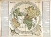
Horizon de Paris
1 Karte : Kupferdruck ; Durchmesser 48 cm, Bildgrösse 60 x 85 cm Durand; Desbruslins chez le Sr. Durand rüe St. Jacques à St. Landry
Asia
Stieler's Hand-Atlas Stieler, Adolf bei Justus Perthes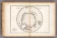
Carte des glaces australes.
1 : 42000000 Vincent
Asia
Hand-Atlas über alle Theile der Erde nach dem neuesten Zustande und über das Weltgebäude Stieler, Adolf bei Justus Perthes
The River systems of Asia & Europe
The physical atlas Johnston, Alexander Keith William Blackwood & Sons
Asia
A new general atlas of modern geography, consisting of a complete collection of maps of the four quarters of the globe Wyld, James James Wyld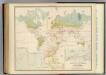
Health, disease.
1 : 67000000 Johnston, Alexander Keith, 1804-1871
Planisphere physique.
1 : 60000000 L'Isle, Guillaume de, 1675-1726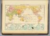
Religions.
1 : 114000000 Andree, Richard; Times (London, England)
Wereldkaart volgens Mercator's projectie
Bruxelles : Institut National de Géographie
Schlegel's Versuch Einer Schlangen-Karte.
1 : 165000000 Berghaus, Heinrich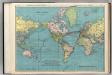
World on Mercator's Projection.
1 : 60000000 Rand McNally and Company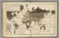
Moral, political World.
1 : 133000000 Woodbridge, William C.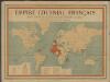
Empire colonial français
1 : 28000000 Barrère, Henry; Ligue coloniale française Paris : Maison Andriveau-Goujon H. Barrère
Carte générale de toutes les parties connues de la surface de la terre en carte réduite
země světa Bonne, Rigobert
Planisphere physique où l'on voit du pole septentrional ce que l'on connoît de terres et de mers
1 Karte : Kupferdruck ; Durchmesser 34 cm Buache; Dezauche; Desbruslins chez Dezauche succ.r des Srs. De l'Isle et Buache ... rue des Noyers près celle des Anglois