Maps of Africa

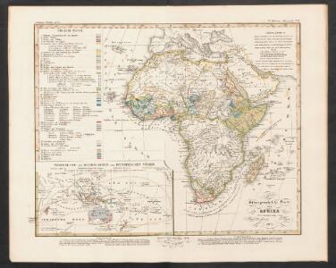
Ethnographische Karte von Afrika
Zweiter Band, enthaltend in vier Abtheilungen die Vertheilung der Organismen: 5. Pflanzen-Geographie, 6. Thier-Geographie, 7. Anthropographie, 8. Ethnographie Humboldt, Alexander von Verlag von Justus Perthes
Afrika
Handatlas über alle Theile der Erde und über das Weltgebäude Stieler, Adolf Justus Perthes

Afrika
Stieler's Hand-Atlas Stieler, Adolf bei Justus Perthes
Africa
1 : 30000000 Calcografia Vignozzi Calcogafia Vignozzi
Afrika

Afrika
Hand-Atlas über alle Theile der Erde nach dem neuesten Zustande und über das Weltgebäude Stieler, Adolf bei Justus Perthes
Afrika
Hand-Atlas über alle Theile der Erde und über das Weltgebäude Stieler, Adolf Justus Perthes
Afrika
Hand-Atlas über alle Theile der Erde nach dem neuesten Zustande und über das Weltgebäude Stieler, Adolf bei Justus Perthes
Florenkarte von Afrika und Australien
Atlas der Pflanzenverbreitung Drude, Oscar Justus Perthes
Répresentation du cours ordinaire des vents de traverse qui regnent sur les côtes dans la grande mer du Sud
1 Karte : Kupferdruck ; 15 x 30 cm Cosmant Didot
Tiré de l'ouvrage les missions catholiques d'Afrique en 1889
1 : 20000000 Bethune, Léon Société de St. Augustin
Oceanien.
1 : 42000000 Ziegler, J. M.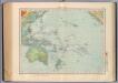
162-63. Oceania fisica.
1 : 30000000 Touring club italiano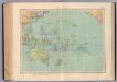
164-65. Oceania politica.
1 : 30000000 Touring club italiano
Afrika.
1 : 37000000 Stulpnagel, F.v.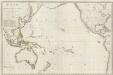
Composite: Oceanie.
1 : 15500000 Brue, Adrien Hubert, 1786-1832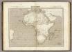
Afrique.
1 : 20000000 Montemont, A.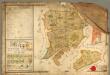
Mappa der zur k.k. Stadt Pilsner gehörigen und von der Hradecker abgetheilte = Bukssitzer
Rukopisná hospodářská mapa lesního revíru Švabiny a Lišky. Oba plány mají stejné měřítko. Značkami a barvou je vyznačen charakter a kvalita porostu. Jsou vyznačeny komunikace, hraniční kameny, 1 malá vodní plocha, 1 usedlo, jména sousedících panství. Vlevo nahoře tabulka s výměrou jednotlivých typů porostů na pozemcích, vlevo dole vysvětlivky značek, vpravo grafické a číselné měřítko v kompozici s neumělou alegorickou postavou.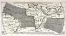
Réprésentation du cours ordinaire des vents de traverse qui regnent le long des côtes dans la mer Atlantique [et] celle des Indes
1 Karte : Kupferdruck ; 15 x 30 cm Cosmant Didot
Afrika
E. von Sydow's Schul-Atlas in sechs und dreissig Karten Sydow, Emil von bei Justus Perthes
Pacific Ocean. Pergamon World Atlas.
Polish Army Topography Service
Mapa de África / por José Paluzie Lucena, ingeniero. 1924
1 : 16000000 1 Mapa. Hijo de Paluzie, S. en C. Casa editorial. Diputació 337, Barcelona Paluzie Lucena, José Hijo de Paluzie, S. en C. Casa editorial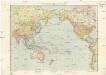
Pazifik
1 : 35000000 Tichý oceán-oblast E. Fastr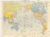
Der Pazifische Raum
1 : 30000000 Tichý oceán Verlagsanstalt List & von Bressensdorf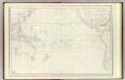
Grand Ocean.
1 : 25000000 France. Depot-general de la Marine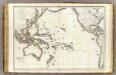
Oceanie.
1 : 29500000 Brue, Adrien Hubert, 1786-1832
Oceanica.
1 : 55000000 Gray, Ormando Willis
Pacific Ocean
1 : 35000000 Aleutské ostrovy (Aljaška) National Geographic Society