Maps of British Isles

[Schotland mit der Nördlichen Spitze von England]
Stieler's Hand-Atlas Stieler, Adolf bei Justus Perthes
[Schotland mit der Nördlichen Spitze von England]
Hand-Atlas über alle Theile der Erde nach dem neuesten Zustande und über das Weltgebäude Stieler, Adolf bei Justus Perthes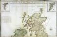
Les isles Britanniques, 1
2 Blätter : 50 x 85 cm Desnos
Partie, l'Angleterre. Europe 7.
1 : 1641836 Vandermaelen, Philippe, 1795-1869
Feuille 16 (B III), uit: Carte géologique internationale de l'Europe : la carte, votée au congrès géologique international de Bologne en 1881, est exécutée conformément aux décisions d'une commission internationale, avec le concours des gouvernements, sous le dir. de M.M. Beyrich et Hauchecorne
Annotatie: Blad 48 gamme des couleurs; blad 49: bladwijzer en titelblad Heinrich Ernst Beyrich 1815-1896; Wi. Hauchecorne Berlin : Reimer / (Berlin: Institut lithographique)
Soubor němých map pro gymnasia a odborné školy

British Isles.
1 : 2500000 Andree, Richard; Times (London, England)
[Großbritannien und Irland]
Irsko
[Grossbritannien; England, Scotland und Ireland]
Geographischer Atlas über alle Theile der Erde Ziegler, Jakob Melchior Verlag von Joh. Wurster um Comp.
Britischen Inseln.
1 : 1800000 Kiepert, Heinrich, 1818-1899
British Islands.
1 : 5500000 Fitch, George W.
Gt. Britain, Ireland.
1 : 4800000 Mitchell, Samuel Augustus
Iles Britanniques.
1 : 2500000 Andriveau-Goujon, J.
British Isles.
1 : 5000000 Adams, Daniel
Atlas für Industrie- und Handelsgeographie: Für commercielle und technische Lehranstalten, für Kaufleute und Industrielle
The north part of Great Britain called Scotland.
from The world described, or, A new and correct sett of maps : shewing the kingdoms and states in all the known parts of the earth, with the principal cities, and most considerable towns in the world ... / ... by Herman Moll, geographer ...
Karte des Brittischen Reichs
1 : 2700000 Irsko Brué, Adrien Hubert bey Artaria et Comp.
Welká Britanie a Iry

Atlas für Handel und Industrie: Für Kaufleute, Fabrikante u. Gewerbetreibende, Handlungs- u. Gewerbe-Schulen

[Grossbritannien; England, Scotland und Ireland]
Geographischer Atlas über alle Theile der Erde Ziegler, Jakob Melchior Verlag von Dietrich Reimer
Bretagne apres l'invasion des Saxons, 500 ans apres Jesus Christ.
1 : 4500000 Houze, Antoine Philippe
Parliamentary map, British Isles.
1 : 1774080 Stanford, Edward
Geological, palaeontological map British Islands.
1 : 1550000 Johnston, Alexander Keith, 1804-1871

Railway map, British Isles.
1 : 1774080 Stanford, Edward
Carte Physique et Mineralogique des Isles Britanniques
1 : 15000000 Malte-Brun, Conrad, 1775-1826
Angleterre, Irelande & Ecosse 1281 a 1400.
1 : 4500000 Houze, Antoine Philippe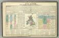
Tableau l'historie des Iles Britanniques.
1 : 8200000 Duval, Henri
Bretagne Anglo Saxonne, 800 ans apres J.C.
1 : 4500000 Houze, Antoine Philippe
British Isles (outline)
1 : 4500000 Patteson, Edward
![[Schotland mit der Nördlichen Spitze von England]](https://images-2.georeferencer.com/images/iiif/815074594307/full/,300/0/native.jpg)

