Maps of Rynholec

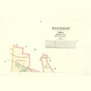
Waschirow - c8334-1-002 - Kaiserpflichtexemplar der Landkarten des stabilen Katasters
1 : 2880
Waschirow - c8334-1-001 - Kaiserpflichtexemplar der Landkarten des stabilen Katasters
1 : 2880
Indikační skica mapy stabilního katastru pro obec Lány (předměstí města Litomyšle) IV
1 : 2880
Rinholetz (Rinholec) - c6667-1-002 - Kaiserpflichtexemplar der Landkarten des stabilen Katasters
1 : 2880
Rinholetz (Rinholec) - c6667-1-003 - Kaiserpflichtexemplar der Landkarten des stabilen Katasters
1 : 2880
Rinholetz (Rinholec) - c6667-1-004 - Kaiserpflichtexemplar der Landkarten des stabilen Katasters
1 : 2880
Rinholetz (Rinholec) - c6667-1-001 - Kaiserpflichtexemplar der Landkarten des stabilen Katasters
1 : 2880
Stochow - c7349-1-001 - Kaiserpflichtexemplar der Landkarten des stabilen Katasters
1 : 2880
Stochow - c7349-1-002 - Kaiserpflichtexemplar der Landkarten des stabilen Katasters
1 : 2880
Gradkartenblatt
1 : 25000 Nové Strašecí-oblast (Česko) Albrecht, Julius
III. vojenské mapování 3952/1
1 : 25000
III. vojenské mapování 3952/1
1 : 25000

Karte des Neustraschitzer Bezirkes im Prager Kreise
1 : 72000 Nové Strašecí-oblast (Česko) Wagner, Jan Eduard in Commission bei Karl André
Karte des Neustraschitzer Bezirkes im Prager Kreise
1 : 72000 Nové Strašecí-oblast (Česko) Wagner, Jan Eduard in Commission bei Karl André
Situations Plan der Herrschaft Pürglitz und Kruschowitz dann des Gutes Nischburg und Wschetat
Křivoklát-oblast (Česko)
Situations-Plan der Fürst zu Fürstenberg'schen Herrschaft Pürglitz, Kruschowitz, dann des Gutes Nischburg, Wschetatt und Wolleschna etc
1 : 84000 Křivoklát-oblast (Česko) Bohutinský, Friedrich Fürstenberg, Karl Egon
Kladno
1 : 75000 Kladno-oblast (Česko) Vojenský zeměpisný ústav
Soubor přehledných map pro plánování a statistiku: 3952 – Kladno

Soubor přehledných map pro plánování a statistiku: 3952 – Kladno

Slanský vikariát
Slaný-oblast (Česko)
III. vojenské mapování 3952
1 : 75000
Kladno
1 : 75000 Kladno (Česko : oblast) Vojenský zeměpisný ústav
Karte des Gemeindegrenzen

Podrobná mapa okolí Pražského
1 : 75000 Kladno (Česko : oblast) Hevera, Čeněk Obec pražská
Podrobná mapa okolí Pražského List I.

Kladno und Schlan
1 : 75000 Kladno (Česko : oblast) Irblich K. u. k. militär-geographisches Institut
Kladno und Schlan
1 : 75000 Kladno (Česko : oblast) Irblich K. u. k. Militärgeographisches Institut
Kladno und Schlan
1 : 75000 Kladno (Česko : oblast) K. u. k. Militärgeographisches Institut