Maps of Řeporyje

Sliwenetz (Sliwenec) - c7041-1-003 - Kaiserpflichtexemplar der Landkarten des stabilen Katasters
1 : 2880
Sliwenetz (Sliwenec) - c7041-1-004 - Kaiserpflichtexemplar der Landkarten des stabilen Katasters
1 : 2880
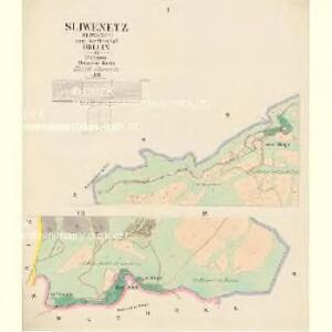
Sliwenetz (Sliwenec) - c7041-1-001 - Kaiserpflichtexemplar der Landkarten des stabilen Katasters
1 : 2880
Sliwenetz (Sliwenec) - c7041-1-002 - Kaiserpflichtexemplar der Landkarten des stabilen Katasters
1 : 2880
Sliwenetz (Sliwenec) - c7041-1-005 - Kaiserpflichtexemplar der Landkarten des stabilen Katasters
1 : 2880
Orientační plán hlavního města Prahy s okolím
1 : 5000
Orientační plán Prahy a obcí sousedních List 26.
1 : 5000
Lochkow - c4201-1-002 - Kaiserpflichtexemplar der Landkarten des stabilen Katasters
1 : 2880
Lochkow - c4201-1-001 - Kaiserpflichtexemplar der Landkarten des stabilen Katasters
1 : 2880
Rzepora - c6699-1-002 - Kaiserpflichtexemplar der Landkarten des stabilen Katasters
1 : 2880
Rzepora - c6699-1-005 - Kaiserpflichtexemplar der Landkarten des stabilen Katasters
1 : 2880
Rzepora - c6699-1-003 - Kaiserpflichtexemplar der Landkarten des stabilen Katasters
1 : 2880
Rzepora - c6699-1-001 - Kaiserpflichtexemplar der Landkarten des stabilen Katasters
1 : 2880
Rzepora - c6699-1-004 - Kaiserpflichtexemplar der Landkarten des stabilen Katasters
1 : 2880
Environs de Hlubočep
1 : 6150 Hlubočepy (Praha, Česko) Barrande, Joachim
Hinter Kopanina (Zadnj Kopanina) - c9026-1-001 - Kaiserpflichtexemplar der Landkarten des stabilen Katasters
1 : 2880
Hinter Kopanina (Zadnj Kopanina) - c9026-1-002 - Kaiserpflichtexemplar der Landkarten des stabilen Katasters
1 : 2880
Hinter Kopanina (Zadnj Kopanina) - c9026-1-003 - Kaiserpflichtexemplar der Landkarten des stabilen Katasters
1 : 2880
Orientační plán hlavního města Prahy s okolím

Orientační plán hlavního města Prahy s okolím
1 : 5000
Výškopisný plán hlavního města Prahy s okolím

Výškopisný plán hlavního města Prahy s okolím

Orientierungsplan der Hauptstadt Prag
Jiřík, Rudolf
Plan der Merckwürdrgen [sic] Belagerung der Stadt Prag in Böhmen Anno 1743
Praha (Česko)
Grundriss der König. Bohmischen Haupt Stadt Prag
Praha (Česko) Christoph Riegel Buchhändlen
Okolí města Prahy na hodinu cesty
Praha-oblast (Česko) K. Hübner
Plan der Hauptstadt Prag und der umliegenden Gegend sammt dem Lustlager der kais. königl. Armée
1 : 47500 Praha (Česko)
Plan der Hauptstadt Prag und der umliegenden Gegend sammt dem Lustlager der kais. königl. Armée
1 : 47500 Praha (Česko)
Umgebung von Prag