Maps of Nedrahovice

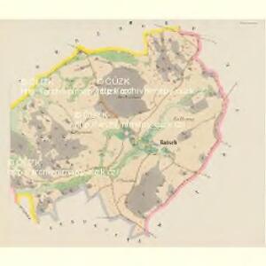
Ratsch - c6321-1-001 - Kaiserpflichtexemplar der Landkarten des stabilen Katasters
1 : 2880
Ratsch - c6321-1-002 - Kaiserpflichtexemplar der Landkarten des stabilen Katasters
1 : 2880
Wisoka - c8944-1-007 - Kaiserpflichtexemplar der Landkarten des stabilen Katasters
1 : 2880
Wisoka - c8944-1-001 - Kaiserpflichtexemplar der Landkarten des stabilen Katasters
1 : 2880
Wisoka - c8944-1-005 - Kaiserpflichtexemplar der Landkarten des stabilen Katasters
1 : 2880
Wisoka - c8944-1-003 - Kaiserpflichtexemplar der Landkarten des stabilen Katasters
1 : 2880
Wisoka - c8944-1-006 - Kaiserpflichtexemplar der Landkarten des stabilen Katasters
1 : 2880
Wisoka - c8944-1-002 - Kaiserpflichtexemplar der Landkarten des stabilen Katasters
1 : 2880
Wisoka - c8944-1-004 - Kaiserpflichtexemplar der Landkarten des stabilen Katasters
1 : 2880
Rothhradek (Czerwenihradek) - c0933-1-006 - Kaiserpflichtexemplar der Landkarten des stabilen Katasters
1 : 2880
Rothhradek (Czerwenihradek) - c0933-1-004 - Kaiserpflichtexemplar der Landkarten des stabilen Katasters
1 : 2880
Rothhradek (Czerwenihradek) - c0933-1-001 - Kaiserpflichtexemplar der Landkarten des stabilen Katasters
1 : 2880
Rothhradek (Czerwenihradek) - c0933-1-005 - Kaiserpflichtexemplar der Landkarten des stabilen Katasters
1 : 2880
Rothhradek (Czerwenihradek) - c0933-1-002 - Kaiserpflichtexemplar der Landkarten des stabilen Katasters
1 : 2880
Rothhradek (Czerwenihradek) - c0933-1-003 - Kaiserpflichtexemplar der Landkarten des stabilen Katasters
1 : 2880
Boor - c0361-1-001 - Kaiserpflichtexemplar der Landkarten des stabilen Katasters
1 : 2880
Boor - c0361-1-002 - Kaiserpflichtexemplar der Landkarten des stabilen Katasters
1 : 2880

Wotický vikariát
Votice-oblast (Česko)
III. vojenské mapování 4153
1 : 75000
Sedlčany
1 : 75000 Sedlčany (Česko : oblast) Vojenský zeměpisný ústav
Sedlčany
1 : 75000 Sedlčany (Česko : oblast) Vojenský zeměpisný ústav
Selčan und Jung-Woschitz
1 : 75000 Mladá Vožice (Česko : oblast) Hertel, A. K. u. k. Militärgeographisches Institut
Selčan und Jung-Woschitz
1 : 75000 Mladá Vožice (Česko : oblast) K. u. k. Militärgeographisches Institut
Vilímkovy místopisné mapy zemí Koruny české
1 : 100000 Milevsko (Česko : oblast) Srp, Jan Jos. R. Vilímek
Politický okres Benešov
1 : 100000 Benešov-oblast (Česko) Kratochvíl, M. Josef Richard Vilímek
Střední povltaví

Politický okres Příbram
1 : 100000 Příbram-oblast (Česko) Josef Richard Vilímek
Politický okres Příbram
1 : 100000 Příbram-oblast (Česko) Kratochvíl, M. Josef Richard Vilímek