Maps of Rtyně nad Bílinou

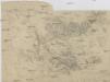
Malhostitz - c4420-1-001 - Kaiserpflichtexemplar der Landkarten des stabilen Katasters
1 : 2880
Malhostitz - c4420-1-002 - Kaiserpflichtexemplar der Landkarten des stabilen Katasters
1 : 2880
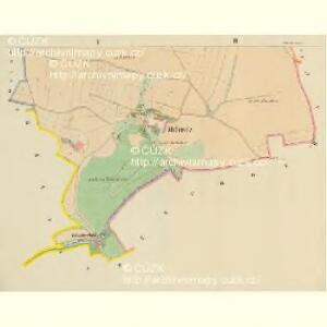
Hertine - c6610-1-001 - Kaiserpflichtexemplar der Landkarten des stabilen Katasters
1 : 2880
Hertine - c6610-1-003 - Kaiserpflichtexemplar der Landkarten des stabilen Katasters
1 : 2880
Hertine - c6610-1-002 - Kaiserpflichtexemplar der Landkarten des stabilen Katasters
1 : 2880
Schichlitz - c9434-1-002 - Kaiserpflichtexemplar der Landkarten des stabilen Katasters
1 : 2880
Schichlitz - c9434-1-001 - Kaiserpflichtexemplar der Landkarten des stabilen Katasters
1 : 2880
Tschochau - c6683-1-002 - Kaiserpflichtexemplar der Landkarten des stabilen Katasters
1 : 2880
Tschochau - c6683-1-001 - Kaiserpflichtexemplar der Landkarten des stabilen Katasters
1 : 2880
Tschochau - c6683-1-003 - Kaiserpflichtexemplar der Landkarten des stabilen Katasters
1 : 2880
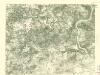
Lochtschitz (Lochčice) - c4202-1-004 - Kaiserpflichtexemplar der Landkarten des stabilen Katasters
1 : 2880
Lochtschitz (Lochčice) - c4202-1-002 - Kaiserpflichtexemplar der Landkarten des stabilen Katasters
1 : 2880
Lochtschitz (Lochčice) - c4202-1-005 - Kaiserpflichtexemplar der Landkarten des stabilen Katasters
1 : 2880
Lochtschitz (Lochčice) - c4202-1-001 - Kaiserpflichtexemplar der Landkarten des stabilen Katasters
1 : 2880
Lochtschitz (Lochčice) - c4202-1-003 - Kaiserpflichtexemplar der Landkarten des stabilen Katasters
1 : 2880
Welboth - c8476-1-002 - Kaiserpflichtexemplar der Landkarten des stabilen Katasters
1 : 2880
Welboth - c8476-1-001 - Kaiserpflichtexemplar der Landkarten des stabilen Katasters
1 : 2880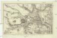
Plan der Gegend bey Linay in Böheim
1 : 32000 Hliňany (Řehlovice, Česko)
Karte des politischen Bezirkes Aussig

Teplitz
Geologischer Atlas zur Naturgeschichte der Erde Leonhard, Carl Cäsar von E. Schweizerbart'sche Verlagsbuchhandlung
[Kartenblatt]
1 : 25000 Lovosice (Česko : oblast) Reichsamt für Landesaufnahme
III. vojenské mapování 3752/3
1 : 25000
III. vojenské mapování 3752/3
1 : 25000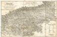
Teplitz mit seinen Umgebungen
1 : 28800 Teplice-oblast (Česko) Stein, Carl
Pohlig's Karte von Teplitz und dessen Umgebung
Teplice-oblast (Česko) J.W. Pohlig
III. vojenské mapování 3752/3
1 : 25000
Die Herschaft Toeplitz im Leutmeritzer Creisse des Königreichs Boehmen
1 : 80000 Mollova mapová sbírka Zürner, Adam Friedrich Schenk, Peter II
Uibersichtskarte der Aussig Teplitzer Eisenbahn und der in dieselbe einmündenden Zweigbahnen