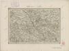
Maps of Starkoč

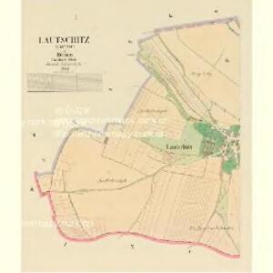
Lautschitz (Lautčic) - c4264-1-002 - Kaiserpflichtexemplar der Landkarten des stabilen Katasters
1 : 2880
Lautschitz (Lautčic) - c4264-1-001 - Kaiserpflichtexemplar der Landkarten des stabilen Katasters
1 : 2880
Starkotsch (Starkoč) - c7284-1-002 - Kaiserpflichtexemplar der Landkarten des stabilen Katasters
1 : 2880
Starkotsch (Starkoč) - c7284-1-003 - Kaiserpflichtexemplar der Landkarten des stabilen Katasters
1 : 2880
Starkotsch (Starkoč) - c7284-1-001 - Kaiserpflichtexemplar der Landkarten des stabilen Katasters
1 : 2880
Lipowetz - c4125-1-001 - Kaiserpflichtexemplar der Landkarten des stabilen Katasters
1 : 2880
Lipowetz - c4125-1-002 - Kaiserpflichtexemplar der Landkarten des stabilen Katasters
1 : 2880
Winarz (Winaře) - c8591-1-001 - Kaiserpflichtexemplar der Landkarten des stabilen Katasters
1 : 2880
Winarz (Winaře) - c8591-1-003 - Kaiserpflichtexemplar der Landkarten des stabilen Katasters
1 : 2880
Winarz (Winaře) - c8591-1-002 - Kaiserpflichtexemplar der Landkarten des stabilen Katasters
1 : 2880
Podhorzan - c5888-1-002 - Kaiserpflichtexemplar der Landkarten des stabilen Katasters
1 : 2880
Podhorzan - c5888-1-003 - Kaiserpflichtexemplar der Landkarten des stabilen Katasters
1 : 2880
Podhorzan - c5888-1-001 - Kaiserpflichtexemplar der Landkarten des stabilen Katasters
1 : 2880
Podhorzan - c5888-1-004 - Kaiserpflichtexemplar der Landkarten des stabilen Katasters
1 : 2880
Okolí Chotusic r. 1742
1 : 72000 Chotusice (Česko) Spudil, V. B. Pluth, Franz nákladem knihtiskárny Rohlíčka a Sieversa
III. vojenské mapování 4055/1
1 : 25000
III. vojenské mapování 4055/1
1 : 25000
Gradkartenblatt
1 : 25000 Čechy (Česko) Ducke, Ludwig
Nástěnná mapa hejtmanství Čáslavského
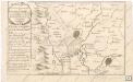
Accurater Plan der bludigen Battalie bey Czaslav in Böhmen...

Podrobné mapy zemí Koruny české v měřítku 1:75.000 a mapa vzdáleností všech míst při silnici ležících - Kutná Hora - Čáslav - Golčův Jeníkov. Průvodce statisticko-historický po všech místech na těchto mapách uvedených a rejstřík věcný názvů hor, potoků, řek, rybníků atd. Sešit 21. List 82,
1 : 75000
8. Kraj Pardubický

III. vojenské mapování 4055
1 : 75000
Časlau und Chrudim
1 : 75000 Chrudim (Česko : oblast) Mugerauer K. u. k. militär-geographisches Institut
Časlau und Chrudim
1 : 75000 Chrudim (Česko : oblast) Mugerauer K. u. k. militär-geographisches Institut
Časlau und Chrudim
1 : 75000 Chrudim (Česko : oblast) Mugerauer K. u. k. Militärgeographisches Institut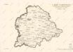
8. Kraj Pardubický

Chrudim
1 : 75000 Chrudim-oblast (Česko) Vojenský zeměpisný ústav
Podrobná mapa Království českého
1 : 100000 Chotěboř (Česko : oblast) Srp, Jan Jaroslav Bursík