Maps of Běchovice

Biechowitz (Běchowice) - c0176-1-003 - Kaiserpflichtexemplar der Landkarten des stabilen Katasters
1 : 2880
Biechowitz (Běchowice) - c0176-1-001 - Kaiserpflichtexemplar der Landkarten des stabilen Katasters
1 : 2880
Biechowitz (Běchowice) - c0176-1-004 - Kaiserpflichtexemplar der Landkarten des stabilen Katasters
1 : 2880
Biechowitz (Běchowice) - c0176-1-002 - Kaiserpflichtexemplar der Landkarten des stabilen Katasters
1 : 2880
Unt. Poczernitz (Dolnj Poczernice) - c1362-1-004 - Kaiserpflichtexemplar der Landkarten des stabilen Katasters
1 : 2880
Unt. Poczernitz (Dolnj Poczernice) - c1362-1-001 - Kaiserpflichtexemplar der Landkarten des stabilen Katasters
1 : 2880
Unt. Poczernitz (Dolnj Poczernice) - c1362-1-002 - Kaiserpflichtexemplar der Landkarten des stabilen Katasters
1 : 2880
Unt. Poczernitz (Dolnj Poczernice) - c1362-1-003 - Kaiserpflichtexemplar der Landkarten des stabilen Katasters
1 : 2880
Kollodeg (Kolodeg) - c3287-1-007 - Kaiserpflichtexemplar der Landkarten des stabilen Katasters
1 : 2880
Kollodeg (Kolodeg) - c3287-1-009 - Kaiserpflichtexemplar der Landkarten des stabilen Katasters
1 : 2880
Kollodeg (Kolodeg) - c3287-1-008 - Kaiserpflichtexemplar der Landkarten des stabilen Katasters
1 : 2880
Kollodeg (Kolodeg) - c3287-1-002 - Kaiserpflichtexemplar der Landkarten des stabilen Katasters
1 : 2880
Kollodeg (Kolodeg) - c3287-1-003 - Kaiserpflichtexemplar der Landkarten des stabilen Katasters
1 : 2880
Kollodeg (Kolodeg) - c3287-1-001 - Kaiserpflichtexemplar der Landkarten des stabilen Katasters
1 : 2880
Kollodeg (Kolodeg) - c3287-1-005 - Kaiserpflichtexemplar der Landkarten des stabilen Katasters
1 : 2880
Kollodeg (Kolodeg) - c3287-1-006 - Kaiserpflichtexemplar der Landkarten des stabilen Katasters
1 : 2880
Kollodeg (Kolodeg) - c3287-1-004 - Kaiserpflichtexemplar der Landkarten des stabilen Katasters
1 : 2880
Rev. Neuhof.
1 : 2200 Klánovice (Praha, Česko) Kohut, Josef Líčka, Josef
Dubecz - c1584-1-004 - Kaiserpflichtexemplar der Landkarten des stabilen Katasters
1 : 2880
Dubecz - c1584-1-003 - Kaiserpflichtexemplar der Landkarten des stabilen Katasters
1 : 2880
Dubecz - c1584-1-001 - Kaiserpflichtexemplar der Landkarten des stabilen Katasters
1 : 2880
Dubecz - c1584-1-005 - Kaiserpflichtexemplar der Landkarten des stabilen Katasters
1 : 2880
Dubecz - c1584-1-002 - Kaiserpflichtexemplar der Landkarten des stabilen Katasters
1 : 2880
Dubecz - c1584-1-006 - Kaiserpflichtexemplar der Landkarten des stabilen Katasters
1 : 2880
Výškopisný plán hlavního města Prahy s okolím
Bez titulu: Plán železniční dopravy v Praze a okolí

Mapa zastupitelských a soudních okresů Kr. Vinohradského a Jílovského...

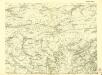
Gradkartenblatt
1 : 25000 Čechy (Česko) Czechák, Carl
III. vojenské mapování 3953/4
1 : 25000