Maps of Iran
Karte des westlichen Hochlandes von Mittel-Asien
1 : 6500000 Afghánistán Roost, I. B. Arrowsmith, John Verlag der literarisch-artistischen Anstalt der I.G. Cotta'schen Buchhandlung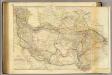
Central Asia.
1 : 4400000 Burnes, Alexander, Sir.
Central Asia.
1 : 4435200 Arrowsmith, John
Nova imperii Persici delineatio / juxta recentiss. et accuratiss. observat. Adriani Relandi proposit
1 : 5600000 1 Karte : Kupferdruck ; 47 x 56 cm Seutter, Matthäus [Matthäus Seutter]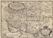
Persici Sive Sophorum Regni Typus. [Karte], in: Theatrum orbis terrarum, S. 402.
1 Karte aus Atlas Ortelius, Abraham Vrients, Jan Baptista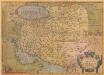
Persici Sive Sophorum Regni Typus. [Karte], in: Theatrum orbis terrarum, S. 113.
1 Karte aus Atlas Ortelius, Abraham
Persici Vel Sophorum Regni Typus [Karte], in: Gerardi Mercatoris Atlas, sive, Cosmographicae meditationes de fabrica mundi et fabricati figura, S. 526.
1 Karte aus Atlas Mercator, Gerhard Montanus, Petrus
W. Hochasien.
1 : 7500000 Flemming, Carl
Hoch-Asien
Stieler's Hand-Atlas Stieler, Adolf bei Justus Perthes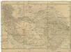
Central-Asien
1 : 4600000 Asie střední Arrowsmith, John Burnes, Alex Geographisches Institut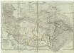
Central-Asien nemlich Bokhara, Cabool, Persien, der Indus Strom und die oestlich des selben gelegenen Laender
1 : 4600000 Asie střední Arrowsmith, John Burnes, Alex Geographisches Institut

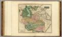
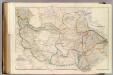
Iran, Turan, Afghanistan, Beludschistan, Turkestan.
1 : 9500000 Radefeld, Carl Christian Franz, 1788-1874
Carte pour l'intelligence des voyages d'Alexandre Burnes, a Lahor, Caboul, Balkh, Boukhara et a travers la Perse en 1831, 1832 et 1833
1 : 10000000 Buchara (Uzbekistán) Tardieu, Ambroise Arrowsmith, John Arthus Bertrand
[Jran Turan, Persien, Afghanistan, Beludschistan, Turkestan]
Grosser Hand-Atlas über alle Theile der Erde in 170 Karten Meyer, J. Verlag des Bibliographischen Instituts
Iran, Turan und West Turkestan
Schul-Atlas in 36 Karten Völter, Daniel Verlag der J.M. Dannheimer'schen Buchhandlung
Nona Asie Tabula [Karte], in: [Clavdii Ptholomei Cosmographi ...], S. 326.
1 Karte aus Atlas Nicolaus Germanus [und Ptolemaeus, Claudius]
Iran & Turan
Adolf Stieler's Handatlas über alle Theile der Erde und über das Weltgebäude Stieler, Adolf Justus Perthes
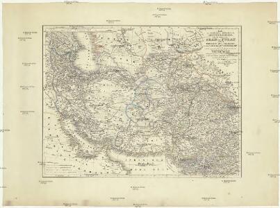
Iran, Afghanistan und Beludschistan
1 : 5400000 entworfen und gezeichnet von C.F. Weiland Weimar : Verlag des Geograph. Instituts
[Iran & Turan oder Persien, Afghanistan, Balutschistan, Turkestan]
Handatlas über alle Theile der Erde und über das Weltgebäude Stieler, Adolf Justus Perthes
[Nona Asie tabula] [Karte], in: Clavdii Ptholomei Viri Alexandrini Cosmographie, S. 182.
1 Karte aus Atlas Nicolaus Germanus [und Ptolemaeus, Claudius]
Royaume de Perse et du Royaume de Afghanistan.
1 : 8000000 Vivien de St Martin, L.
Iran, Afghanistan, Beludschistan.
1 : 4780000 Weiland, C. F. (Carl Ferdinand), d. 1847
Iran & Turan Oder: Persien, Afghanistan, Balutschistan, Turkestan.
1 : 7500000 Petermann, A.
Asia occidental II
1 mapa. Datat al s.XIX. 0 Gras y compañía, editores. Madrid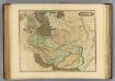
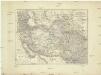
Persia.
1 : 6200000 Lizars, Daniel

Oriens.
1 : 25000000 Fenner, Rest.