Maps of Alaska
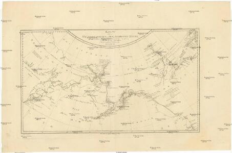
Karte von den n.w. amerikanischen und n.oe. asiatischen Küsten
Severní Amerika-oblast severozápadní Roberts, Heinrich Lackner, I. C. von F.A. Schraembl
Karte von den N.W. Amerikanischen und N.Oe. Asiatischen Küsten
1 : 8800000 Severní Amerika-oblast severozápadní Roberts, Heinrich Lackner, I. C. von F. A. Schraembl
Territory of Alaska (Russian America).
1 : 7000000 Colton, G.W.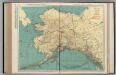
Alaska.
1 : 4055000 Rand McNally and Company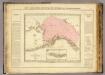
Possessions russes.
1 : 7600000 Pierron, Jean Antoine
Alaska.
1 : 8200000 Rand McNally and Company
North America...N.W. Sheet.
1 : 7500000 Tanner, Henry S.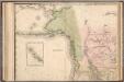
North America...N.W. Sheet.
1 : 7500000 Tanner, Henry S.
Territory of Alaska.
1 : 7500000 Colton, G.W.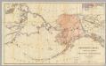
Northwestern America Showing The Territory Ceded By Russia To The United States.
1 : 5000000 Sumner, Charles
NW America.
1 : 11900000 Mitchell, Samuel Augustus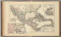
Mexico, Central America, West Indies.
1 : 12000000 Mitchell, Samuel Augustus
NW America.
1 : 11900000 Mitchell, Samuel Augustus Jr.
NW America.
1 : 11900000 Mitchell, Samuel Augustus
NW America.
1 : 11900000 Mitchell, Samuel Augustus
Alaska.
1 : 7315000 Colton, G. Woolworth
Alaska.
1 : 3817000 U.S. General Land Office
Map Of Alaska.
1 : 3484800 Punnett Brothers
Alaska.
1 : 8400000 Rand McNally and Company
Alaska.
1 : 8200000 Rand McNally and Company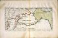
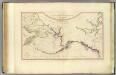
Carte der Entdekvngen zwischen Sibirien und America bis auf das Jahr 1780
1 Karte : Kupferdruck ; 18 x 40 cm Pallas s.n.
Behring's Sea and Arctic Ocean : from surveys of the U.S. North Pacific Surveying Expedition in 1855, Commander John Rodgers U.S.N. commanding and from Russian and English authorities
1 : 4400000 United States. Hydrographic Office U.S. Navy, Hydrographic Office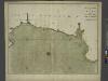
The sea-coast of FRANCE from Havre de Grace to Cape de Barfleur
from The sea-atlas : containing an hydrographical description of most of the sea-coasts of the known parts of the world.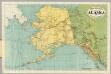
Rand-McNally Official 24x36 Map Of Alaska.
1 : 3611520 Rand McNally and Company
Map of Alaska
1 : 5000000 [Washington, D.C. : U.S. Geological Survey]
Amerique Russe, regions polaires boreales.
1 : 13000000 Garnier, F. A., 1803-1863
Territory of Alaska.
1 : 7500000 Colton, G.W.
N.W. coast America, N.E. coast Asia.
1 : 8700000 Cook, James, 1728-1779
[Historisch-geographischer Atlas zu den allgemeinen Geschichtswerken von C. v. Rotteck, Pölitz u. Becker] : Russland zur Uebersicht dieses Staates
von Julius Loewenberg Lithographie von B. Herder in Freiburg im Breisgau [Freiburg im Breisgau] : [Herder]