Maps of Plasy

[Umgebung von Kralowitz]
1 : 75000 Kralovice (Plzeň-sever, Česko : oblast) K. u. k. Militärgeographisches Institut
Kralovice a okolí
1 : 75000 Kralovice (Plzeň-sever, Česko : oblast) Vojenský zeměpisný ústav
Katastrální mapa obce Kopidlo-Kočín
1 : 2880
Situační plán hájoven náležejících k panství Plasy
1 : 25000
Generální mapa lesů velkostatku Plasy
1 : 13186
General Karte von der hochfürstlich von Metternich'schen Herrschaft Plass mit den vereinten Gütern Katzerow Kraschau u. Biela
1 : 150000 Horní Bělá-oblast (Česko) Wiehl, Anton Metternich, Klemens Wenzel Nepomuk Lothar von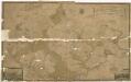
Generální mapa panství Plasy se statkem Krašov (bez Kaceřova a Horní Bělé)
1 : 11611

Gradkartenblatt
1 : 25000 Kralovice-oblast (Plzeň-sever, Česko) Bulla, Eduard
Přehledná mapa velkostatku Manětín podle stavu k roku 1905
1 : 37500

III. vojenské mapování 4051/1
1 : 25000
III. vojenské mapování 4051/1
1 : 25000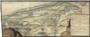
[Plasy]
Plasy-oblast (Česko)
Mapa výhradních kutišť knížete Richarda von Metternich u Žihle
1 : 2918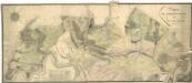
Porostní mapa polesí Plasy
1 : 2918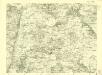
III. vojenské mapování 3951/3
1 : 25000
Gradkartenblatt
1 : 25000 Jesenice-oblast (Rakovník, Česko) Bulla, Eduard
[Kartenblatt]
1 : 25000 Blatno (Louny, Česko) Reichsamt für Landesaufnahme
Gradkartenblatt
1 : 25000 Podmokly (Rokycany, Česko) Bulla, Eduard
III. vojenské mapování 4051/2
1 : 25000
III. vojenské mapování 4051/2
1 : 25000
Mapa polesí Doubrava
1 : 5000
Katastrální mapa obce Dražeň
1 : 2880
Porostní mapa polesí Olšany
1 : 2880
Mapa části polesí Plasy
1 : 5000
Mapa polesí Lomany
1 : 5000
Klein Lohowitz, Rakonitzer Kr[eis]
1 : 2880 Hlohovičky (Hlohovice, Česko)
![[Umgebung von Kralowitz]](https://images-0.georeferencer.com/images/iiif/078069263747/full/,300/0/native.jpg)

