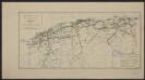
Maps of M'Sila
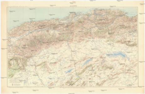
Alger
1 : 500000 Service géographique de l'armée
Dépt D’ Alger carte politique
Vidal de La Blache, Paul
Carte des étapes de la province d'Alger
1 : 1000000 E. Corny Alger : A. Jourdan
Département d'Alger. Carte des voies de communication
1 : 400000 Calléja; Algérie. Direction de l'agriculture et de la colonisation Alger : lith. Adolphe Jourdan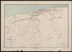
Département d'Alger. Carte des voies de communication
1 : 400000 Calléja; Algérie. Direction de l'agriculture et de la colonisation Alger : lith. Adolphe Jourdan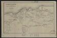
Congrès d'Alger. Carte des excursions
1 : 1000000 Adolphe Jourdan Alger : A. Jourdan
Boghari
1 : 200000 Maumias; Algérie. Service cartographique Alger : Adolphe Jourdan

Djurjura
1 : 200000 Maumias; Algérie. Service cartographique Alger : Adolphe Jourdan
Bou-Saada
1 : 200000 Maumias; Algérie. Service cartographique Alger : Adolphe Jourdan
Alger
1 : 200000 Maumias; Algérie. Service cartographique Alger : Adolphe Jourdan
Miliana
1 : 200000 Maumias; Algérie. Service cartographique Alger : Adolphe Jourdan
Téniet-El-Had
1 : 200000 Maumias; Algérie. Service cartographique Alger : Adolphe Jourdan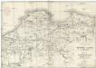
Carte routiere des environs d'Alger
1 : 125000 Alžír (Alžírsko) Raoul Miaux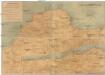
Les environs d'Alger
1 : 120000 Mac Carthy, Oscar Bastide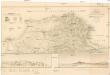
Karte zur Uibersicht der Expedition der königl. französischen Armee nach Algier in Jahre 1830
1 : 370000 Alžírsko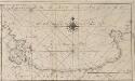
Afteekeningh van de reede van Algiers
Algeria Gerard van Keulen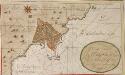
De reede van Alzijra of Argiera in de Middelandse Zee aen de kust van Barbarija over Il. Majorka
Algeria Gerard van Keulen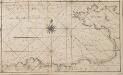
Afteekening van de anker plaets agter Cachique digt bij Algiers bewesten
Algeria Gerard van Keulen
De batteryen der stad Algiers
1 : 10000 C.A. v. Schaik lith.
Algeri
1 : 2000 Alžír (Alžírsko) Florimi, Matteo Niebuhr, Carsten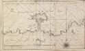
Afteekeningh van de reede van Cercelli bewesten Algiers
Algeria Gerard van Keulen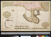
Afteekening van de baij en reede van Algiers of Argiera geteekent in een platte grond geleegen in de Middelandse Zee
Algeria Gerard van Keulen
Sétif
1 : 200000 Maumias; Algérie. Service cartographique Alger : Adolphe Jourdan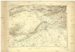
Environs de Biskra
1 : 100000 Alžírsko Service géographique de l'armée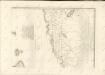

Dépt D’ Alger carte physique
Vidal de La Blache, Paul
Algeria Colonie Francaise.
1 : 4000000 Levasseur, Victor.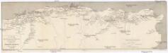
Carte des chemins de fer Algériens et Tunisiens
Alžírsko Adolphe Jourdan