Maps of New Town

[Plan von Prag]
Praha (Česko) Die Wirtschaft
Nejnovější plán král[ovského] hlav[ního] města Prahy s okolím
Praha (Česko : oblast) Wagner, Jan Eduard Brož, J. Alois Hynek
Grundriss der königlichen Hauptstadt Prag
Praha (Česko) Jüttner, Josef Drda, Josef Jan Alois Nationalmuseum
Grundriss der königlichen Hauptstadt Prag
Praha (Česko) Jüttner, Josef Drda, Josef Jan Alois Nationalmuseum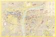
Praha : kulturní památky
1 : 7500
Plan der königl. Hauptstadt Prag
1 : 11000 Praha (Česko) Zelený, Franz Friedrich Kretzschmar
Neuester Grundrisz von Prag
1 : 10500 Praha (Česko) Kronberger und Weber
Newest Situations-Plan of Prague
Praha (Česko)
Polohopisný plán královského hlavního města Prahy kolem roku 1870
1 : 7400 Praha (Česko) Skramovský, František Mayr, Josef V. Neubert
Grundriss der Kais Konigl. Hauptstadt Prag im Königreich Böhmen

Grundriß der k. k. Hauptstadt Prag und ihres nächsten Umgebungen
1 : 13500 Praha (Česko) Wöllner, Leopold Pluth, Caspar Gottlieb Haase Söhne
Grundriß der k. k. Hauptstadt Prag und ihres nächsten Umgebungen
1 : 13500 Praha (Česko) Wöllner, Leopold Pluth, Caspar Gottlieb Haase Söhne
Niveau-Karte der Stadt Prag
1 : 20000
Grundriss von Prag, nach den besten Hülfsmitteln dargestellt
1 : 125000 gestochen von W. Schuldes Prag : J. G. Calve'sche Buchhandlung
Plan von Prag

Polohopisný plán Prahy
Praha (Česko) K. Hübner
Eigentlicher Grundriß der Königlichen Statt Prag
Praha (Česko)
Praha. Mapy staré Prahy k letům 1200, 1348 a 1419

Grundriss der kön. Hauptstadt Prag in Böhmen
Praha (Česko) Zürner, Georg Adam im Verlage des Kunst und Industrie Comptoirs
Neynowěgšj plán Prahy a wůkolj
Praha (Česko) Kamernik, Josef
Orientační plán hlavního města Prahy s okolím
1 : 5000
Polohopisný plán Prahy k roku 1891

Polohopisný plán Prahy k roku 1815

Polohopisný plán Prahy k roku 1994

[Praha-Staré Město]
Praha (Česko) Vasquez Pinos, Karl Rauh, Johann
[Plán centra Prahy]
Praha (Česko)
Plán asanačních obvodů v Praze
1 : 1440 Praha (Česko)
[Grundrisz der königlichen Hauptstadt Prag]
Praha (Česko) Jüttner, Josef Drda, Josef Jan Alois auf Veranlassung und Kosten des böhmischen Nationalmuseums
Staré Město / Nové Město

![[Plan von Prag]](https://images-0.georeferencer.com/images/iiif/513121087037/full/,300/0/native.jpg)

