Maps of Carpathian Mountains
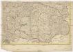
[Uhry]
1 : 914000 Maďarsko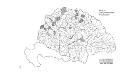
Die konservativen Wahlbezirke
Ungarn Wahlbezirk, Wahlverhalten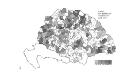
Die Bezirke der Tendenz "B" nach 1875
Ungarn Wahlbezirk, Wahlverhalten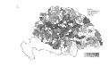
Die Bezirke der Tendenz "B" vor 1875
Ungarn Wahlbezirk, Wahlverhalten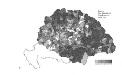
Die Bezirke der Tendenz "A" nach 1875
Ungarn Wahlbezirk, Wahlverhalten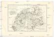
Royaume de Hongrie et pays adjacents
1 : 3420000 Maďarsko Bonne, Rigobert André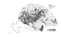
Die Bezirke der Tendenz "C" nach 1875
Ungarn Wahlbezirk, Wahlverhalten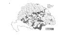
Die Bezirke der Tendenz "C" vor 1875
Ungarn Wahlbezirk, Wahlverhalten
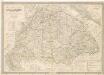
Strassen-Karte des Koenigreiches Ungarn
1 : 430000 Uhersko A. Floder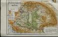
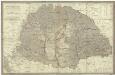
Mountains and plains of the old kingdom of Hungary [Nebenkarte]
Ungarn Topografie Teleki, Pál Teleki, Pál
Skelett für die Special-Karte des Königreichs Ungarn mit dem Grofsfürstenthume Siebenbürgen, der Königreiche Croatien u[nd] Slavonien, dann der k.k. Militärgrenze
1 : 75000 Chorvatsko K. u. k. Militärgeographisches Institut
Allgemeine Charte vom Königreiche Ungarn
1 : 1500000 Chorvatsko Liechtenstern, Joseph Marx von Berken von Ottendorff, Johann Kunst und Industrie Comptoirs
Allgemeine Charte vom Königreiche Ungarn
1 : 1500000 Chorvatsko Liechtenstern, Joseph Marx von Berken von Ottendorff, Johann im Verlage des Kunst und Industrie Comptoirs
Magyarország hegy- és vizrajzi térképe
1 : 3500000 Karpaty (pohoří : oblast) Homolka, Josef Posner Károly Lajos és Fia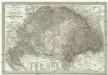
General - Post- und Strassen- Karte des Königreichs Ungarn und des Grossfürstenthums Siebenbürgen
1 : 1400000 Maďarsko Fried, Franz List, Joseph Artaria
Tabula generalis regni Hungariae, Croatiae et Slavoniae nec non magni principatus Tranylvaniae
1 : 1400000 Chorvatsko Lipský, Ján Marcum Berra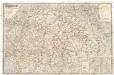
Magyarország és Horvát-Szlavonország
1 : 900000 Evropa východní Eggenberger-féle könyvkereskedés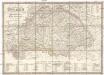
Karte von Königreich Ungarn und den zugehörigen Nebenländern
1 : 1887000 Maďarsko Schmitfeldt, Georg Lipský, Ján Florian Mollo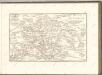
Die Kaiserlich Oesterreichischen Ungarischen Erbstaaten
Magyar országnak
1 : 1000000 Maďarsko Engelmann Karacs Ferentz
Hungary.
1 : 2500000 Andree, Richard; Times (London, England)
Ungarn.
1 : 2500000 Andree, Richard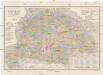
Orts- und Strassenkarte des Königreiches Ungarn
1 : 1296000 Chorvatsko Steinhauser, Anton Artaria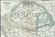
Ungarn 1848, 1849
1 : 7400000 Ungarn Ungarn / Revolution <1848-1849>
Provincia Austriaca Societatis Iesu
Evropa jihovýchodní Seutter, Matthäus Mayr, Johann Baptist Matthäus Seutter
Provincia Austriaca Societatis Iesu
Evropa jihovýchodní Seutter, Matthäus Kappus, Marcus Antonius a Matthaeo Seutter
Magyar-Ország : General-, Post- und Strassen-Karte des Königreichs Ungarn und des Grossfürstenthums Siebenbürgen / gezeichnet von F. Fried ; gestochen von J. List
1 : 127500 Annotatie: Met administratieve indeling Fried, F.; List, J. Wien : Artaria
Postkarte des Königreichs Ung.Übersciht von Wien über Ofen bis Kronstadt ; und von Venedig, Triest, Fiume bis Lemberg und Brody
Ungarn Kroatien Postroute Verkehrsweg
![[Uhry]](https://images-0.georeferencer.com/images/iiif/624892068799/full/,300/0/native.jpg)

