Maps of Alps

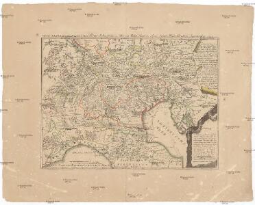
Neue Karte von den franzoesischen Kriegs-Schauplatze in Ober und Mittel Italien, Tyrol, Friaul, Krain, Kaernthen, Steyermark etc
1 : 1720000 Furlandsko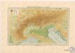
Höhenschichtenkarte der Alpen

Permanente Befestigungen
Győr (Maďarsko) K.k. Generalstabes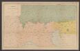
Sprachkarte der Alpen
1 : 2000000 Wäber, Adolf ; Leuzinger, Rudolf [Verlag der Expedition des Jahrbuches des S.A.C.]
Italie Septentrionale.
1 : 1500000 Clouet, J. B. L. (Jean-Baptiste Louis), b. 1730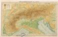
Höhenschichtenkarte der Alpen
Carta postale et itineraria dell'Italia
Itálie severní Botte, A. F. Deyé A.F. Botte
Übersichtskarte des südwestlichen Kriegsschauplatzes
1 : 750000 Evropa jihovýchodní k. u. k. Hof- und Universitätsbuchhandlung R. Lechner (W. Müller)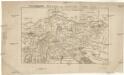
Vindelicien Rhetien und Noricvm
Noricum Baumgarten, Siegmund Jakob Johann Justinus Gebauer
Hypsometrische Uebersichtskarte der Alpen
1 : 1744000 Alpy (pohoří) Steinhauser, Anton Papen, August Artaria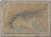
Hypsometrische Uebersichtskarte der Alpen
1 : 1744000 Alpy (pohoří) Steinhauser, Anton Papen, August Artaria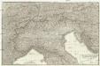
Carte dell'Italia superiore e di parte degli stati limitrofi
1 : 1000000 Itálie severní Bacler Dalbe, Louis Albert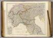
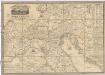
North Italy &c. (with) Sardinia.
1 : 1267200 Arrowsmith, John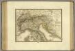
Italie, Suisse, Illyrie sud.
1 : 2100000 Brue, Adrien Hubert, 1786-1832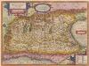
Italia Gallica, Sive Gallia Cisalpina. [Karte], in: Theatrum orbis terrarum, S. 389.
1 Karte aus Atlas Ortelius, Abraham
Italia Gallica, Sive Gallia Cisalpina. [Karte], in: Theatrum orbis terrarum, S. 490.
1 Karte aus Atlas Ortelius, Abraham Vrients, Jan Baptista
[Kaart], uit: Carta automobilistica alla scala di 1:650.000. [Italia del Nord], foglio 1 / Touring Club Italiano
1 : 650000 Touring Club Italiano Milano : Touring Club Italiano
Partie, l'Italie. Europe 20.
1 : 1641836 Vandermaelen, Philippe, 1795-1869
Carte itinéraire indiquant la marche des armées Françaises en Allemagne et en Italie : faisant suite à la carte en 8 feuilles de L. Capitaine ... / par P.C. Chanlaire
1 : 850000 Annotatie: Overige bl. niet aanwezig Chanlaire, P. C Paris : Dépot de Géographie
Postkarte von Ober Italien
Itálie severní Stenger, Johann im von Reillyschen Landkarten und Kunstwerke Verschleiss Komptoir
Feuille 31 (C V), uit: Carte géologique internationale de l'Europe : la carte, votée au congrès géologique international de Bologne en 1881, est exécutée conformément aux décisions d'une commission internationale, avec le concours des gouvernements, sous le dir. de M.M. Beyrich et Hauchecorne
Annotatie: Blad 48 gamme des couleurs; blad 49: bladwijzer en titelblad Heinrich Ernst Beyrich 1815-1896; Wi. Hauchecorne Berlin : Reimer / (Berlin: Institut lithographique)
Lombardia quae sedes belli in Italia est comprehendens respublicas Venetam et Genuensem, Mediolanensem ducatum status ducum Sabaudiae, Modenae, Parmae, Mantuae cum plurimis imperialibus et ecclesiast. ditionibus insertis feudis
1 : 800000 per F. de Witt Amstel. : F. de Witt
Severovýchodní Italie a alpské země rakouské s Přímořím, Istrii [sic] a Chorvatskem
1 : 1000000 Alpy rakouské-oblast Emil Šolc
Bez titulu: Slepá hydrografická mapa jihovýchodní Evropy

Italie Septentrionale.
1 : 1500000 Vivien St Martin, L.
Dominio Veneto Nell' Italia. [Karte], in: Le théâtre du monde, ou, Nouvel atlas contenant les chartes et descriptions de tous les païs de la terre, Bd. 3, S. 84.
1 Karte aus Atlas Blaeu, Willem Janszoon und Blaeu, Joan Blaeu, Willem Janszoon
Dominio Veneto Nell' Italia. [Karte], in: Novus Atlas, das ist, Weltbeschreibung, Bd. 3, S. 96.
1 Karte aus Atlas Blaeu, Joan Blaeu, Willem Janszoon
Karte von Ober-Italien
1 : 900000 Leuzinger, Rudolf J. Wurster & Cie.
Italien 1.
1 : 1800000 Flemming, Carl