Maps of Usti Nad Labem
Plan von Obersedlitz
Střekov (Ústí nad Labem, Česko)
Ober Sedlitz - c7447-1-001 - Kaiserpflichtexemplar der Landkarten des stabilen Katasters
1 : 2880
Ober Sedlitz - c7447-1-002 - Kaiserpflichtexemplar der Landkarten des stabilen Katasters
1 : 2880
Schreckenstein - c7446-1-002 - Kaiserpflichtexemplar der Landkarten des stabilen Katasters
1 : 2880
Schreckenstein - c7446-1-001 - Kaiserpflichtexemplar der Landkarten des stabilen Katasters
1 : 2880
Schreckenstein - c7446-1-003 - Kaiserpflichtexemplar der Landkarten des stabilen Katasters
1 : 2880
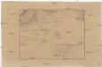
Plan von Aussig
1 : 2880 Ústí nad Labem (Česko : oblast) Stadtrate
Oustí
Ústí nad Labem (Česko) Košťál, Václav Hennig, C.
Aussig - c8272-1-001 - Kaiserpflichtexemplar der Landkarten des stabilen Katasters
1 : 2880
Aussig - c8272-1-004 - Kaiserpflichtexemplar der Landkarten des stabilen Katasters
1 : 2880
Aussig - c8272-1-005 - Kaiserpflichtexemplar der Landkarten des stabilen Katasters
1 : 2880
Aussig - c8272-1-006 - Kaiserpflichtexemplar der Landkarten des stabilen Katasters
1 : 2880
Aussig - c8272-1-003 - Kaiserpflichtexemplar der Landkarten des stabilen Katasters
1 : 2880
Aussig - c8272-1-002 - Kaiserpflichtexemplar der Landkarten des stabilen Katasters
1 : 2880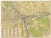
Pharus-Plan Aussig
1 : 11500 Ústí nad Labem (Česko) Löwe, Cornelius A. Grohmanns Buchhdlg. Nachf. Karl Tuch
Geologische Karte des Böhmischen Mittelgebirges
1 : 25000 České středohoří (Česko) Hibsch, Josef Emanuel Alfred Hölder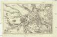
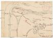
Plan der Gegend bey Linay in Böheim
1 : 32000 Hliňany (Řehlovice, Česko)
III. vojenské mapování 3752/1
1 : 25000

III. vojenské mapování 3752/1
1 : 25000
III. vojenské mapování 3752/1
1 : 25000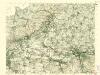
III. vojenské mapování 3752/1
1 : 25000
III. vojenské mapování 3752/1
1 : 25000
[Kartenblatt]
1 : 25000 Krupka (Česko : oblast) Reichsamt für Landesaufnahme
Die Schlacht bei Kulm am 29. u. 30. August 1813
Chlumec (Ústí nad Labem, Česko) Loquens, Jos. Bormann, E.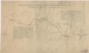
Uibersichtskarte der Aussig Teplitzer Eisenbahn und der in dieselbe einmündenden Zweigbahnen
[Bitva u Chlumce a Přestanova]
Chlumec (Ústí nad Labem, Česko) Langweil, Antonín
Herrschaft Toeplitz im Leutmeritzer Creisse des Koenigreichs Böhmen
1 : 230000 Teplice-oblast (Česko)
Die Herschaft Toeplitz im Lautmeritzer Creisse des Königreichs Boehmen


