Maps of Central Lowland

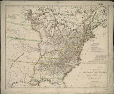
Die Vereinigten Staaten von Nord-America

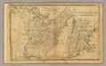
An accurate map of the United States of America: according to the Treaty of Peace of 1783.
from Whole Published as the Act directs by H.D. (Henry Delahoy) Symonds: London; Russell, John,
Übersichtskarte über die Endmoräne der zweiten Glacialepoche Nord Amerikas nach T. C. Chamberlin 1882
1 : 15000000 gez. v. E. Geinitz aut. v. C. Schmidt Gotha : Perthes
United States.
1 : 10700000 Carey, Mathew
United States.
1 : 10700000 Carey, Mathew
Karte der katholischen Diocesen und deren Missionen in Nordamerika nach den neuesten geographischen Angaben
1 : 22430000 Spojené státy americké-oblast východní Salzbacher, Joseph Engel, H. Joseph Salzbacher
Map Of The United States
1 : 2300000 Vance, David H.
CHARTE von den VEREINIGTEN STAATEN von NORD-AMERICA mit LUISIANA
Spojené státy americké-oblast východní
United States.
from Whole Published by Thomas & Andrews: [Boston]; Lewis, Samuel,
United States.
1 : 11400000 Arrowsmith, Aaron; Lewis, Samuel
United States.
1 : 11400000 Lewis, Samuel
Etats Unis et Canada.
1 : 8400000 Montemont, A.
Watson's new rail-road and distance map of the United States and Canada.
1 : 2344320 Watson, Gaylord
U.S.A. (outline)
1 : 11800000 Patteson, Edward
U.S.A.
1 : 11800000 Patteson, Edward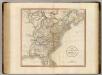
United States of America.
1 : 5900000 Cary, John, ca. 1754-1835
A new map of the United States of America, from the latest authorities / by John Cary, engraver.
from Whole John Cary,
Die Vereinigten Staaten von Nord-Amerika
Allgemeiner Atlas [Walch, Johannes] im Verlag bei Johannes Walch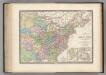
Region Orientale des Etats-Unis, Canada.
1 : 7000000 Levasseur, E.
Lay's map of the United States / compiled from the latest and best authorities and actual surveys by Amos Lay, geographer and map publisher ; engraved by O.H. & D.S. Throop & Wm. Chapin.
from Whole
Composite: United States.
1 : 1584000 Smith, J. Calvin
The United States of America, according to the Treaty of Peace of 1784 / Russell, del. et sculpt.
from Whole Russell,
Map of the United States of America.
1 : 6500000 Winterbotham, W.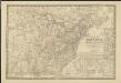
Nouvelle carte des États-Unis, du Haut et Bas-Canada, de la Nouvelle-Écosse, du Nouvau-Brunswick, de Terre-Neuve, etc.
1 : 4000000 dressée par A. H. Brué, géographe du Roi Paris : chez l'auteur
United States of America.
1 : 1960000 Tanner, Henry S.
The Seat of Civil War in America.
The Seat of Civil War in America. Published by Smith & Son of London in August 1863, The Seat of Civil War in America highlights the Union and Confederate states, as well as clearly marking the Border States in yellow. Interestingly this map still presents Virginia as one state. The smaller map shows the Seat of War in Virginia, detailing the areas of the state closest to Maryland and Washington, D.C., as well as southern Pennsylvania. Smith & Son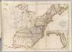
Map of the United States.
1 : 3660000 Carey, Mathew
Map of the United States.
1 : 3675000 Carey, Mathew
United States Of North America.
1 : 1550000 Arrowsmith, Aaron