Maps of India
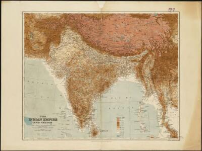
The Indian Empire and Ceylon
1 : 7500000
Vorder-Indien oder das Indo-Britische Reich
Hand-Atlas über alle Theile der Erde nach dem neuesten Zustande und über das Weltgebäude Stieler, Adolf bei Justus Perthes
India
1 : 15000000 J.W. Clement Co.
India
1 : 8000000 Afghánistán James, J. O. N. Surveyor general's office
India
1 : 8000000 Asie jižní James, J. O. N. Surveyor general's office
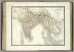
Empire du Mogol.
1 : 14000000 Clouet, J. B. L. (Jean-Baptiste Louis), b. 1730
Ost-Indien oder Vorder-Indien
Schul-Atlas in 36 Karten Völter, Daniel Verlag der J.M. Dannheimer'schen Buchhandlung
l'Indie.
1 : 20200000 Malte-Brun, Conrad, 1775-1826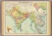
India & Farther India - political.
1 : 10000000 John Bartholomew & Co.
Decima Asiae Tabula [Karte], in: Claudii Ptolemei viri Alexandrini mathematice discipline philosophi doctissimi geographie opus [...], S. 220.
1 Karte aus Atlas Waldseemüller, Martin [und Ptolemaeus, Claudius] Übelin, Georg
Ost Indien.
1 : 9500000 Ziegler, J. M.
Ost Indien
Hypsometrischer Atlas Ziegler, Jakob Melchior Topogr. Anstalt v. J. Wurster u. Comp.
[Ost Indien, Mit besonderer Berücksichtigung der englischen Besitzungen]
Geographischer Atlas über alle Theile der Erde Ziegler, Jakob Melchior Verlag von Joh. Wurster um Comp.
An accurate map of Hindostan or India, from the best authorities.
from Carey's general atlas, improved and enlarged : being a collection of maps of the world and quarters, their principal empires, kingdoms, &c.
Language Map of India and ist Border Lands
L'Inde.
1 : 10100000 Lapie, M. (Pierre), 1779-1850
Hindostan or India.
1 : 9000000 Carey, Mathew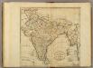
Map of Hindostan or India.
1 : 9500000 Carey, Mathew
Hindostan or India.
1 : 14572800 Carey, Mathew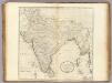
Map of Hindostan or India.
1 : 10264320 Carey, Mathew
Map of Hindostan or India.
1 : 10264320 Carey, Mathew
Ad antiquam Indiae geographiam tabula.
1 : 11300000 Anville, Jean Baptiste Bourguignon d, 1697-1782
[Vorder-Indien oder Ango-Indische Reich]
Hand-Atlas über alle Theile der Erde und über das Weltgebäude Stieler, Adolf Justus Perthes
Composite: India.
1 : 4457000 Johnston, Alexander Keith, 1804-1871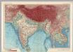
India and Indochina. Pergamon World Atlas.
1 : 10000000 Polish Army Topography Service
134-135. India, Pakistan, Ceylon, Nepal, Political. The World Atlas.
1 : 7500000 USSR (Union of Soviet Socialist Republics).
Composite: India.
1 : 4000000 John Bartholomew & Co.
Composite: India.
1 : 5448960 Stanford, Edward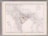
India and Adjacent Countries. Coal Resources of the World.
1 : 8553600 McInnes, William; Leach, W.W.; Dowling, D.B.