Old maps of Lonnig

Discover the past of Lonnig on historical maps

Browse the old maps

Discovering the Cartography of the Past

Lonnig


Parent places:

Maps of Lonnig

Maps of Lonnig

$title$

Meßtischblatt 3269 : Bassenheim, 1935

1 : 250000 Bassenheim. - Hrsg. 1902, bericht. 1935. - 1:25000. - [Berlin]: Reichsamt für Landesaufnahme, 1935. - 1 Kt.
$title$

Meßtischblatt 3269 : Bassenheim, 1902

1 : 250000 Bassenheim. - Aufn. 1900. - 1:25000. - [Berlin]: Kgl. Preuss. Landesaufnahme, 1902. - 1 Kt.
$title$

[25] Sect. Coblenz, uit: Geologische Karte der Rheinprovinz und der Provinz Westphalen / ausgeführt durch H. von Dechen

1 : 80000 titelvariant: Dechen's geologische Karte vom Rheinland und Westphalen; Annotatie: Titel op bladoverzicht; Incompleet Heinrich von Dechen Berlin : Schropp
$title$

Carte Particuliere de Pays qui sont situéz entre le Rhein, la Saare, la Moselle, et la Basse Alsace

1 : 150000 Mollova mapová sbírka Jaillot, Alexis-Hubert Jaillot, Alexis Hubert
$title$

Die Nider Graffschafft Catzenellenbogen Sampt dero angrentzende Länder

1 : 80000 Mollova mapová sbírka Person, Nikolaus Person, Nicolas
$title$

Le Flambeau de la Guerre Allumee au Rhin

Mollova mapová sbírka Delisle, Guillaume Schenk, Peter II
$title$

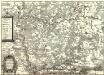
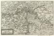
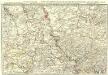
179 Simmern, uit: Topographische Special-Karte von Deutschland (von Central-Europa) / begründet von D.G. Reymann ; [entworfen und gezeichn. von Heinrich Berghaus... [et al.]]

1 : 200000 Annotatie: Lit.: Daniel Gottlob Reymann und die "Topographische Special-Karte von Deutschland" / von Wolfgang Scharfe, in: Kartographische Nachrichten, 39 (1989), Heft I, p. 1-10; Handgeschreven titel: Reymann's Deutschland : 24 Sectionen: Jena, Penig, Dresden, Zittau, Hirschberg, Breslau, Brieg, Andernach, Coblenz, Giessen, Fulda, Schleusingen, Plauen, Zwickau, Teplitz, Jung Bunzlau, Hohenelbe, Glatz, Neisse, Simmern, Prag, Luxemburg, Birkenfeld; Aanwezig: 23 bladen Reymann, Daniel Gottlob; Berghaus, Heinrich [Berlin : 2. Departement des Kriegsministeriums, Bureau für Plan- und Kartenzeichnung]
$title$

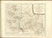
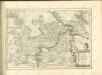
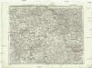
160 Andernach, uit: Topographische Special-Karte von Deutschland (von Central-Europa) / begründet von D.G. Reymann ; [entworfen und gezeichn. von Heinrich Berghaus... [et al.]]

1 : 200000 Annotatie: Lit.: Daniel Gottlob Reymann und die "Topographische Special-Karte von Deutschland" / von Wolfgang Scharfe, in: Kartographische Nachrichten, 39 (1989), Heft I, p. 1-10; Handgeschreven titel: Reymann's Deutschland : 24 Sectionen: Jena, Penig, Dresden, Zittau, Hirschberg, Breslau, Brieg, Andernach, Coblenz, Giessen, Fulda, Schleusingen, Plauen, Zwickau, Teplitz, Jung Bunzlau, Hohenelbe, Glatz, Neisse, Simmern, Prag, Luxemburg, Birkenfeld; Aanwezig: 23 bladen Reymann, Daniel Gottlob; Berghaus, Heinrich [Berlin : 2. Departement des Kriegsministeriums, Bureau für Plan- und Kartenzeichnung]
$title$

Dioecesis Trevirensis Tractvs Mosellanvs Inferior

1 : 50000 Mollova mapová sbírka Person, Nikolaus Person, Nicolas
$title$

$title$

138. Coblenz, uit: Topographische Uebersichtskarte des Deutschen Reiches / herausgegeben v. d. Kartogr. Abt. d. Königl. Preuß. Landesaufnahme

1 : 200000 titelvariant: Topogr. Übersichtskarte des Deutschen Reiches; Annotatie: Titel boven bladen ook: Topogr. Übersichtskarte des Deutschen Reiches; Annotatie geografische gegevens: Op elk blad twee maatstokken: 10 Kilometer = 5,5 cm; 1 geogr. Meile = 3,6 cm; Legenda onder op elk blad Königlich Preußische Landesaufnahme. Kartographische Abtheilung [S.l : Königlich Preußische Landesaufnahme, Kartographische Abtheilung]
$title$

Mosella et Rheni Confluxus

Mollova mapová sbírka Person, Nikolaus Person, Nicolas
$title$

Nassoviae Principatus et ad cum spectantes Ditiones

1 : 180000 Mollova mapová sbírka Seutter, Matthäus Seutter, Matthäus
$title$

Mosellauf von Koblenz bis Trier : mit seitlich angebrachtem Führer

Annotatie: Op omslag: Nr. 28 Da; Met beschrijving van bezienswaardigheden aan weerszijden van de kaart Köln : Bremer
$title$

Partie Orientale du Temporel, de l'Archevesché et Eslectorat de Treves

1 : 220000 Mollova mapová sbírka Sanson, Guillaume Jaillot, Alexis Hubert
$title$

$title$

Theatre de la Guerre sus la Mosella, avec le choc., qui se donna entre les deux Armées le 20. Octobre 1735

Mollova mapová sbírka
$title$

Neue Topographische Carte Der Lahn von Marburg bis zu ihrem Einflus in den Rhein mit Bemerkung der in dieser Gegend vorgefallenen Kriegsbegebenheiten von 1795 und 1796

Brand, Peter; Thum, C.; Schalck, Anna Maria; Coentgen, Georg Joseph Brand u. Thum
$title$

Prüm 98, uit: Special-Karte von Mittel-Europa / nach amtlichen Quellen bearbeitet von W. Liebenow

1 : 300000 titelvariant: W. Liebenow's Mittel-Europa; Annotatie: Titel boven de bladen: W. Liebenow's Mittel-Europa Johannes Wilhelm Liebenow 1822-1897 Frankfurt a. M. : Ludwig Ravenstein
$title$

Prüm 98, uit: [W. Liebenow's Special-Karte von Mittel-Europa]

1 : 300000 titelvariant: W. Liebenow's Mittel-Europa; Annotatie: Titel boven de bladen: W. Liebenow's Mittel-Europa Johannes Wilhelm Liebenow 1822-1897 Hannover : Hermann Oppermann
$title$

Partie Orientale Du Temporel De L'Archevesché et Eslectorat, De Treves

1 : 210000 Mollova mapová sbírka Sanson, Guillaume Jaillot, Alexis Hubert
$title$

$title$

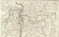
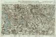
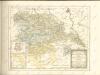
Theatre De La Guerre Dans Les Pays Qui Sont Situéz Entre le Rhin, la Saare, la Moselle et la Basse Alsace. [Karte], in: Atlas nouveau, contenant toutes les parties du monde [...], Bd. 1, S. 235.

1 Karte aus Atlas Sanson, Nicolas Jaillot, Alexis Hubert und Mortier, Pieter
$title$

$title$

Nassovia Comitatvs

1 : 1300000 Mollova mapová sbírka Hondius, Henricus Hondius, Henricus
$title$

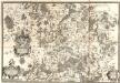
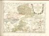
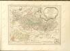
Partie Septentrionalo Des Pays qui sont situéz Entre le Rhein, la Saare, la Moselle, et la Basse Alsace. [Karte], in: Atlas nouveau, contenant toutes les parties du monde [...], Bd. 1, S. 238.

1 Karte aus Atlas Sanson, Nicolas Jaillot, Alexis Hubert und Mortier, Pieter
$title$

$title$

Exactissima totius Vederoviae laté sumtae Tabula

1 : 210000 Mollova mapová sbírka Buna, Wilhelm C. Broenner, Heinrich Ludwig
$title$

Carte topographique tres exacté de la Wetteravie

1 : 220000 Hesensko (Německo) Coentgen, Heinrich Hugo chez I.W.A. Iaeger
$title$

Carte topographique tres exacté de la Wetteravie

1 : 220000 Hesensko (Německo) Jaeger, Johann Wilhelm Abraham I. W. A. Jaeger
© MapTiler © OpenStreetMap contributors
How does it work?
These instructions will show you how to find historical maps online.
Getting started
Type the place name in the search box to find the exact location. You can further adjust the search by zooming in and out.
Zoom
Zoom in and out with the buttons or use your mouse or touchpad natively.
Exact Area tool
Click here and draw a rectangle over the map to precisely define the search area.
Set filters
Narrow your search with advanced settings, such as Years (from/to), Fulltext, Publisher, etc.
Results
See the results of your search on the right side. You can scroll down to find more maps of this location.
?

Download OldMapsOnline Mobile