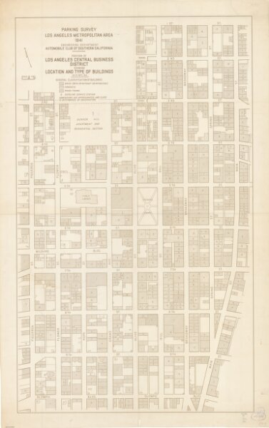
Portion of Los Angeles central business district showing location and type of buildings as of Sept. 1941
ArcGIS, QGIS or web apps can simply
use this map with web map services.
WMTS, TileJSON or XYZ tiles
are provided for quick access to processed maps.
Sign in to get links.