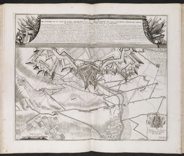
TABLES DES CARTES DES PAYS BAS ET DES FRONTIERES DE FRANCE, Avec un Recueil DES PLANS DES VILLES, SIEGES ET BATTAILLES DONNE ́ES ENTRE LES HAUTS ALLIES ET LA FRANCE.
ArcGIS, QGIS or web apps can simply
use this map with web map services.
WMTS, TileJSON or XYZ tiles
are provided for quick access to processed maps.
Sign in to get links.