ArcGIS, QGIS or web apps can simply use this map with web map services. WMTS, TileJSON or XYZ tiles are provided for quick access to processed maps.
Sign in to get links.
Sign in to download GeoTIFF.
Overlay & compare
iiif viewer, iiif info json
Website
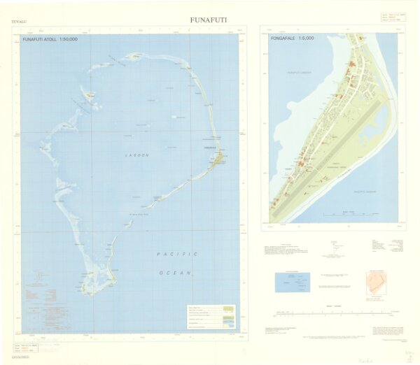
Tuvalu. Funafuti.
G9510_50_DOS_1980
World
Alternate title: Funafuti Atoll 1:50,000. Funafuti Local Grid. Standard map series designation: Series X041. Includes ancillary map of "Fongafale 1:5,000," location map, and reliability diagram.
1980
Great Britain. Directorate of Overseas Surveys.
44 × 60 cm
1 : 50000