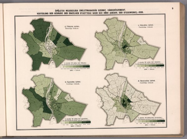
Épületek megoszlása emeletmagasság szerint, városrészenkint. = Verteilung der Gebäude der einzelnen Stadtteile nach der Höhe (Anzahl der Stockwerke). 1930.
ArcGIS, QGIS or web apps can simply
use this map with web map services.
WMTS, TileJSON or XYZ tiles
are provided for quick access to processed maps.
Sign in to get links.