ArcGIS, QGIS or web apps can simply use this map with web map services. WMTS, TileJSON or XYZ tiles are provided for quick access to processed maps.
Sign in to get links.
Sign in to download GeoTIFF.
Overlay & compare
iiif viewer, iiif info json
Website
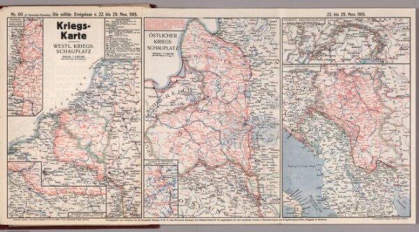
World War I Map (German), Nr. 60. Military Events ... to November 29, 1915.
7821.127
missinglocation
Kriegs-Karte. Nr. 60. Die militaerischen Ereignisse ... bis 29. November 1915.
1915
1919
Mayer, Rudolf
Der Kriegshilfe Munchen N.W (War Help)
63 × 36 cm