ArcGIS, QGIS or web apps can simply use this map with web map services. WMTS, TileJSON or XYZ tiles are provided for quick access to processed maps.
Sign in to get links.
Sign in to download GeoTIFF.
Overlay & compare
iiif viewer, iiif info json
Website
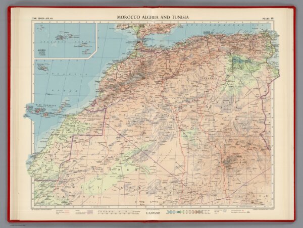
Morocco Algeria and Tunisia, Plate 88, V. IV
1552.226
pilot2
Morocco Algeria and Tunisia. The Geographical Institute Edinburgh. Edited by John Bartholomew, M.C. Copyright - John Bartholomew & Son, LTD. (inset map) Azores (Acores) 1:5,000,000.
1956
1959
Bartholomew, John
John Bartholomew & Son LTD.
62 × 49 cm
1 : 50000000