ArcGIS, QGIS or web apps can simply use this map with web map services. WMTS, TileJSON or XYZ tiles are provided for quick access to processed maps.
Sign in to get links.
Sign in to download GeoTIFF.
Overlay & compare
iiif viewer, iiif info json
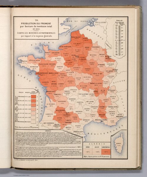
Production du Froment par Hectare du Territoire Total en 1882.
12517.029
missinglocation
Production du Froment par Hectare du Territoire Total en 1882. (Production of wheat per hectare of the total territory.)
1997
1887
Cheysson, Émile
Imprimie Nationale
26 × 34 cm