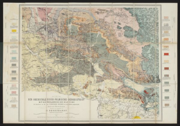
Der Oberschlesisch-Polnische Bergdistrict : geologische Karte : mit Hinweglassung des Diluviums, im Anschluss an die von Ferdinand Roemer ausgeführte geognostische Karte von Ober-Schlesien
ArcGIS, QGIS or web apps can simply
use this map with web map services.
WMTS, TileJSON or XYZ tiles
are provided for quick access to processed maps.
Sign in to get links.