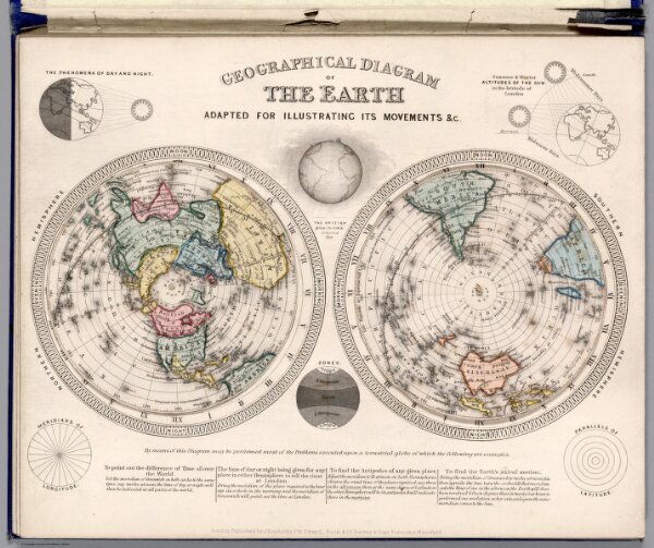
Geographical diagram of the earth : adapted for illustrating its movements &c.
Identifier
3431.003
Collection
missinglocation
Description
Geographical diagram of the earth : adapted for illustrating its movements &c. London. Published by James Reynolds 174 Strand. Rocks & Co. Reeves & Sons. Peacock & Mansfield.(to accompany) Geological Diagrams. (with insets).