ArcGIS, QGIS or web apps can simply use this map with web map services. WMTS, TileJSON or XYZ tiles are provided for quick access to processed maps.
Sign in to get links.
Sign in to download GeoTIFF.
Overlay & compare
iiif viewer, iiif info json
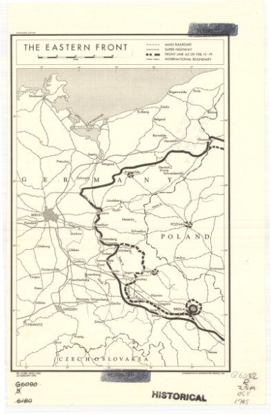
The eastern front
21198_zz002cz2gd
Europe
Shows railways, main highways, and the Front as of Feb. 12-19 (1945.). "Restricted." "No. 6180 - R & A, OSS. 20 February 1945."
1945
United States. Office of Strategic Services. Research and Analysis Branch.
[Washington, D.C.] : Lithographed in Reproduction Branch, OSS
31 × 22 cm
1 : 2280000