ArcGIS, QGIS or web apps can simply use this map with web map services. WMTS, TileJSON or XYZ tiles are provided for quick access to processed maps.
Sign in to get links.
Sign in to download GeoTIFF.
Overlay & compare
iiif viewer, iiif info json
Website
Original viewer
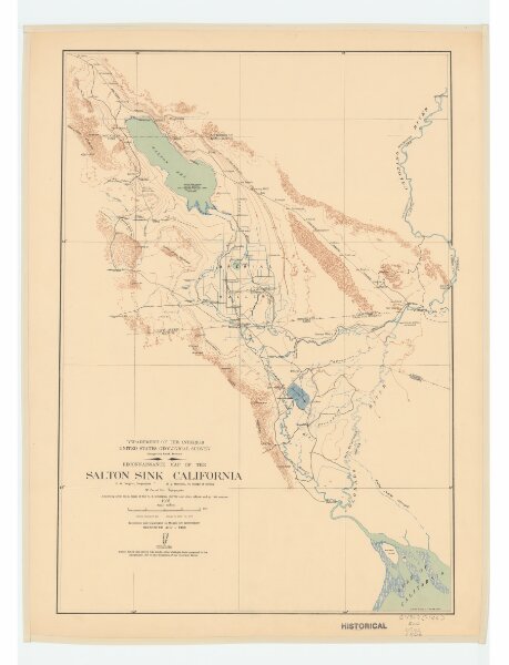
Reconnaissance map of the Salton Sink, California
21198_zz002c18hq
California
Relief shown by contours and spot elevations. "Adjoining areas from maps of the U.S. Geological Survey and other official and private sources."
1906
E.M. Douglas; R.B. Marshall; W. Carvel Hall
Geological Survey (U.S.)
35 × 50 cm
1 : 500000