ArcGIS, QGIS or web apps can simply use this map with web map services. WMTS, TileJSON or XYZ tiles are provided for quick access to processed maps.
Sign in to get links.
Sign in to download GeoTIFF.
Overlay & compare
iiif viewer, iiif info json
Website
11064658865
flickr2
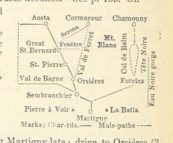
Book: Practical general Continental Guide ... Part I. ... Special edition Anglo-American. 1875 (76, 78, 80, 83, 84)
1875
62.1 × 51.3 cm