ArcGIS, QGIS or web apps can simply use this map with web map services. WMTS, TileJSON or XYZ tiles are provided for quick access to processed maps.
Sign in to get links.
Sign in to download GeoTIFF.
Overlay & compare
iiif viewer, iiif info json
Website
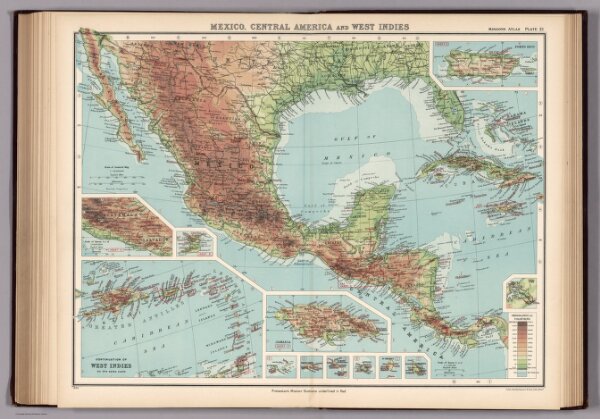
Plate 21. Mexico, Central America and West Indies.
2030.054
missinglocation
1923
1925
Institute of Social and Religious Research
46 × 35 cm
1 : 2500000