ArcGIS, QGIS or web apps can simply use this map with web map services. WMTS, TileJSON or XYZ tiles are provided for quick access to processed maps.
Sign in to get links.
Sign in to download GeoTIFF.
Overlay & compare
iiif viewer, iiif info json
Website
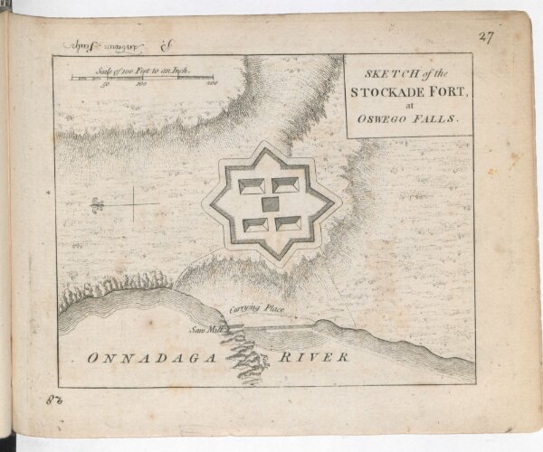
A SET of PLANS and FORTS IN AMERICA Reduced from Actual Surveys. 1765. /
118uau22u029
ktop2
1 atlas containing 31 maps (some folded) illustrated title page index
[1765.]
Rocque, Mary Ann
Mary Ann Rocque