ArcGIS, QGIS or web apps can simply use this map with web map services. WMTS, TileJSON or XYZ tiles are provided for quick access to processed maps.
Sign in to get links.
Sign in to download GeoTIFF.
Overlay & compare
iiif viewer, iiif info json
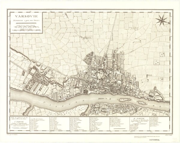
Varsovie superficie 1,900,000 toises
21198_zz002h6cjk
Europe
Oriented with north toward the lower right. Reproduced from an engraving in the collection of Historic Urban Plans. Indexed for points of interest.
1972
Tardieu, P. F. (Pierre François), 1757-1822
Ithaca, N.Y. : Historic Urban Plans
42 × 64 cm
1 : 12500