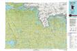
Map of the city of Superior, Douglas County, Wis.
1 : 28800
This map shows streets, railroads, dock and harbor lines, and parks. The map includes population tables for 1880, 1890, 1900.

Map of the harbor at Duluth, Minn., and Superior, Wis. progress sheet no. 1 : dredging district N21 and easterly portion of district N22
1 : 16000
This map shows blocks, industrial buildings, and railroads in portions of Duluth and Superior, as well as harbor lines, areas improved, and proposed improvements "under present project" in Superior Bay, Allouez Bay, and part of St. Louis Bay. Depths are shown by soundings and isolines. North is oriented to the upper left. The top of the map reads: "Soundings are in feet and reduced to low water datum," and the bottom right margin reads: "To accompany my report for the fiscal year ending June 30th, 1898."
United States. Army. Corps of Engineers
U.S. Engineer Office

Chart of Harbor at Duluth, Minn. and Superior, Wisconsin / prepared and first issued under the directions of Colonel J.C. Sanford, and Lieut. Colonel Mason M. Patrick, Corps of Engineers, U.S. Army, in 1914-1915. , Second ed. / rev. and published under the direction of F.G. Ray.
1 : 24000
This map shows details of the harbor, proposed route and bridge changes, railroads, streets, selected buildings, a portion of Lake Superior and other lakes, bays, and rivers in portions of Duluth and Superior. Depths are shown by soundings, contours, and tints. Also included are notes on sailing directions, the water levels of Lake Superior, dry docks, opening and closing of navigation, abbreviations, and uncompleted sketches of McDougall-Duluth Ship Yard piers and Zenith Furnace Co’s pier. The left margin of the map reads:"Issued May 27, 1919 (1200)."
United States. War Dept. Corps of Engineers
United States. War Dept. Corps of Engineers