Mappa catalogata
Norfolk XXXV.15 (includes: Lexham; Rougham; Weasenham All Saints) - 25 Inch Map


Istituzione:National Library of Scotland
Titolo completo:Norfolk XXXV.15 (includes: Lexham; Rougham; Weasenham All Saints) - 25 Inch Map
Anno di illustrazione:1884
Data di pubblicazione:1885
Editore:Ordnance Survey
Scala della mappa:1:2 500
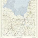
Kings Lynn - OS One-Inch Map
1950
Ordnance Survey
1:63k

Kings Lynn (Outline) - OS One-Inch Revised New Series
1897
Ordnance Survey
1:63k

Kings Lynn (Hills) - OS One-Inch Revised New Series
1897
Ordnance Survey
1:63k

Wisbech (Outline) - OS One-Inch Revised New Series
1897
Ordnance Survey
1:63k

Wisbech (Hills) - OS One-Inch Revised New Series
1897
Ordnance Survey
1:63k
A general plott and description of the Fennes and surounded grounds in the sixe counties of Norfolke, Suffolke, Cambridge
1690
Valck; Schenk
Regiones invndatæ in finibus comitatus Norfolciæ, Svffolciæ, Cantabrigiæ, Hvntingtoniæ Northamtoniæ, et Lincolniæ
1646
Blaeu
A general plott and description of the Fennes and surounded grounds in the sixe counties of Norfolke, Suffolke, Cambridge
1632
Mercator; Hondius

Swaffham (Hills) - OS One-Inch Revised New Series
1897
Ordnance Survey
1:63k

Swaffham (Outline) - OS One-Inch Revised New Series
1897
Ordnance Survey
1:63k