Projeto
Comunidade
Notícias
Meu aplicativo
Os meus mapas
Cataloged map
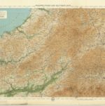
Carmarthen, Sheet 22 - Bartholomew's "Half Inch to the Mile Maps" of England & Wales
Ver no sítio Web externo
Ver digitalizado
Institution:
National Library of Scotland
Full title:
Carmarthen, Sheet 22 - Bartholomew's "Half Inch to the Mile Maps" of England & Wales
Depicted:
1903
Pubdate:
1903
Publisher:
John Bartholomew & Co
Map scale:
1:126 720
História